
The Netherlands is not the first country that comes to mind for motorcycle touring. It should be. Beyond the flat polders and the canals, the country has sea dykes that stretch to the horizon, a genuine hill country tucked between Belgium and Germany, glacial ridges carrying forest roads through the oldest national park in the country, and a string of coastal routes along the Wadden Sea that feel closer to Scandinavia than to Amsterdam. This guide covers ten verified routes across ten distinct regions. Whether you are riding the Netherlands for the first time or filling in the gaps, these are the routes worth your time.
In this guide:
1. Zeeland Delta Route: N57 / N59, Zeeland
Distance: 101 km (Middelburg to Zierikzee via the barriers)
Key structures: Oosterscheldekering storm surge barrier (9 km), Brouwersdam, Grevelingendam
Best for: Coastal touring, engineering landmarks, open-throttle cruising
Best time: May to September, weekday mornings
The Route
This is the best flowing road region in the country and the reason most riders come to Zeeland. The route strings together the Delta Works, the flood defences built after the 1953 North Sea flood killed more than 1,800 people. From Middelburg the N57 climbs north onto the Oosterscheldekering: 9 km across 65 concrete piers, the North Sea to your left and the tidal basin to your right. From Neeltje Jans the road continues onto Schouwen-Duiveland and north over the Brouwersdam, where the angled banking along the dam top is unlike anything else on Dutch roads. Cross onto Goeree-Overflakkee and the route runs east before the Grevelingendam carries you south again onto Schouwen-Duiveland. The final run to Zierikzee closes the loop. There are no tight corners here. What you get instead is scale: long sweeping dyke roads, salt air, and a horizon that runs to the edge in every direction.
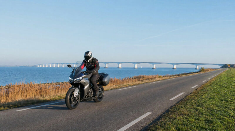
Zeeland Delta Route
Wind is the constant. There is nothing between you and the sea, and crosswinds across the exposed dyke sections are strong enough to move a bike a full lane. Hold a firm line and expect gusts on the barriers. Weekday mornings are near empty. Weekends and warm Sundays fill the barriers and the Brouwersdam with cars and cyclists, so start before 9am if you can. Fuel in Middelburg or Zierikzee before you commit; stations thin out on the islands.
Scenic tip
Standard navigation treats the Zeeland delta as a set of A-to-B crossings and will happily send you down the fastest dual carriageway, skipping the dyke roads that make the region worth riding. Turn on Scenic’s curvy routing setting and it prioritises the coastal N-roads and dyke tops over the direct route, keeping you on the water instead of inland. On a peninsula this fragmented, that is the difference between riding the delta and just driving through it.
Ride this route
Start (Middelburg): 51.4988, 3.6108
Key point (Neeltje Jans, Oosterscheldekering): 51.6332, 3.6998
Key point (Brouwersdam): 51.7516, 3.8266
Key point (Grevelingendam): 51.6791, 4.1498
End (Zierikzee): 51.6512, 3.9186
Or get the whole route free here, with Scenic: https://scenicapp.space/route/Ugkojhvb
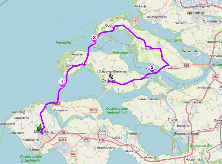
Zeeland Delta Route: N57 / N59, Zeeland
2. Limburg Heuvelland: South Limburg
Distance: 35 km loop (Valkenburg via Gulpen, Wittem, Mechelen, Epen and Slenaken)
Altitude: 274 m (highest point on route, near Epen)
Key roads: N595 Geul valley, Gulp valley lanes
Best for: Real corners, elevation change, the one route that feels un-Dutch
Best time: April to October, avoid Sundays
The Route
South Limburg is the exception to everything else in this guide. This is the only part of the Netherlands with genuine gradient, and riders treat it accordingly. The heuvelland sits in the narrow tongue of land between Belgium and Germany, and its roads connect villages of half-timbered farmhouses and watermill valleys that feel closer to the Ardennes than to the Randstad. The N595 follows the Geul valley southeast from Valkenburg through Oud-Valkenburg and Strucht, climbing through orchards and open hillside to Gulpen. At Gulpen, the Gulpener Brewery has been brewing here since 1825 and the brewery café is the natural stop on the route. From there the route turns south into the Gulp valley through Wittem, and then the lanes continue south through Mechelen and Epen as the landscape tightens and the valley narrows. The return runs southwest through Slenaken and north back to Valkenburg.
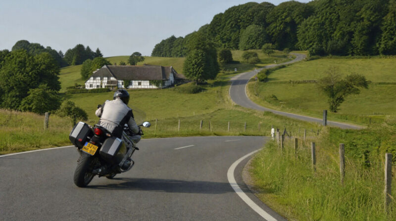
Limburg Heuvelland
None of these climbs are alpine. What Limburg gives you is corner sequences, sightlines that rise and fall, and roads that string wooded valleys together through villages built from Limburg marl. After the flat of the rest of the country, it reads like a different nation. Watch the road surface on the smaller connecting lanes, which can be patchy and greasy under trees after rain. Fuel in Valkenburg or Gulpen. Avoid Sundays: Limburg’s roads fill with cyclists, tourist traffic and slow convoys at weekends, and the good corners lose their flow entirely. Weekday mornings or early on a Saturday are the window.
Off-route detour: From Epen, a short run east on the Viergrenzenweg climbs to the Drielandenpunt at 322 m, the point where the Netherlands, Belgium and Germany meet at the highest point in the European Netherlands. The road has the only serpentine curves in the continental Netherlands. At the top there is Europe’s largest outdoor shrub maze, an observation tower and a border marker where you can stand in three countries at once. Allow an extra 20 minutes.
Scenic tip
The heuvelland is a dense web of tiny lanes and the best of them connect in a loop rather than a line. Use Scenic’s Round Trip feature from Valkenburg, set a distance, and it builds a circular route that links the valley climbs without doubling back or dropping you onto the main road. This is exactly the terrain that feature was built for.
Ride this route
Start / End (Valkenburg): 50.8652, 5.8321
Key point (Gulpen, Gulpener Brewery): 50.8156, 5.8914
Or get the whole route free here, with Scenic: https://scenicapp.space/route/geeINiDZ
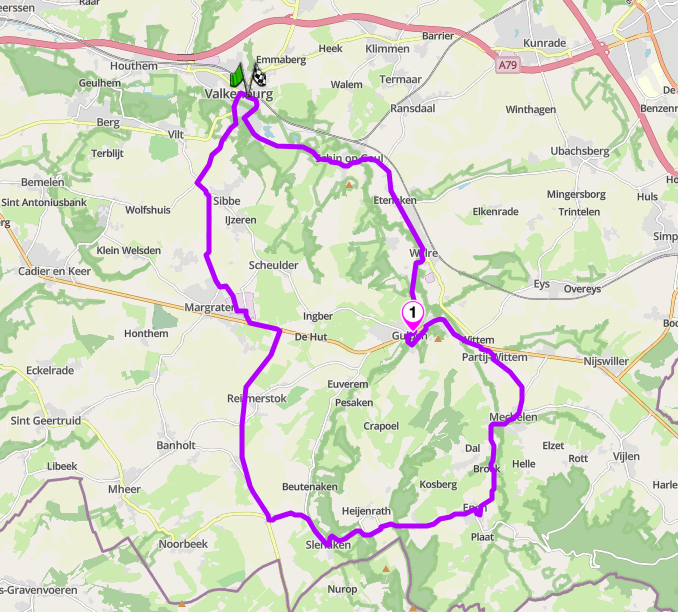
Limburg Heuvelland: South Limburg
3. Veluwezoom, the Posbank and the IJssel: Gelderland
Distance: 48 km (Kasteel Biljoen to Zutphen via the Posbank, Doesburg and Bronkhorst)
Best for: Forest ridge roads, heath views, IJssel crossings, Hanseatic towns
Best time: Late August to mid-September for the heather; September to November for autumn colour; weekday mornings throughout
The Route
The Veluwezoom is the oldest national park in the Netherlands and one of the few places inland where the land actually moves. Glacial ridges push the terrain up into low hills covered in forest and open heath, and the roads that cross them are narrow, properly curved and largely free of through traffic. The route pairs this with the IJssel valley below: river dyke roads, two bridge crossings and a string of Hanseatic towns that give the second half of the day a completely different character from the first.
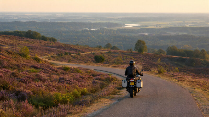
Veluwezoom
From Kasteel Biljoen on the edge of the park, the Beekhuizenseweg and Diepesteeg climb north through the Veluwezoom on curved forest roads to the Posbank viewpoint, where the heather plateau opens up and the IJssel valley spreads below. From there the route drops east and picks up the N317 Ellecomsedijk, a river dyke road running southeast alongside the IJssel toward Doesburg. Just before the town the road crosses De Langebrug over the Dierensche Hank, then immediately the Alexander Ver Huellbrug over the IJssel itself, arriving into Doesburg, a well-preserved Hanseatic town with 150 protected monuments and a medieval street pattern that has survived intact since the 13th century. From there the route heads northeast to Bronkhorst, the smallest city in the Netherlands, a medieval huddle of under a hundred houses on the riverbank. The final leg runs through Baak and Wichmond on a quiet country road through the hedgerow landscape of the Achterhoek, passing Huis Baak on the way into Zutphen.
Scenic tip
The park roads in the Veluwezoom enforce speed limits and close to motor traffic in places. Treat the first section as a slow scenic ride rather than a fast blast, then open up on the N317 dyke road once you reach the river. Late August mornings give you the heather at its best and the Posbank viewpoint to yourself before the walkers and cyclists arrive.
Ride this route
Start (Kasteel Biljoen, Velp): 51.9957, 5.9915
Key point (Posbank viewpoint): 52.0286, 6.0211
End (Zutphen): 52.1483, 6.1942
Or get the whole route free here, with Scenic: https://scenicapp.space/route/VPuMbnau
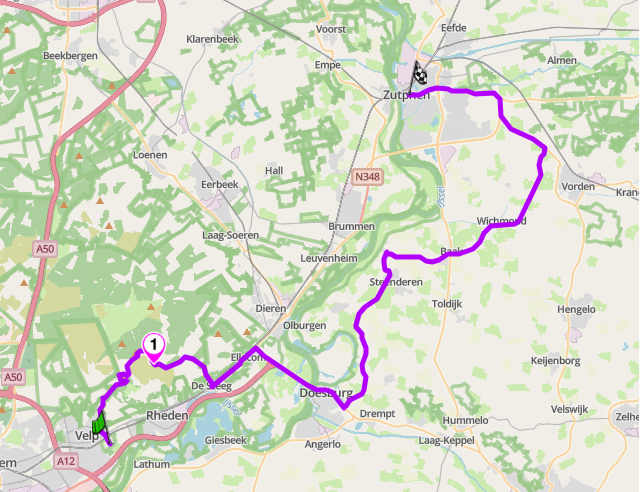
Veluwezoom, the Posbank and the IJssel: Gelderland
4. Utrechtse Heuvelrug: N225 / N227, Utrecht
Distance: 26 km (Amersfoort to Amerongen via the ridge)
Best for: Flowing forest roads, country estates, an easy afternoon
Best time: April to October
The Route
The Utrechtse Heuvelrug is a wooded ridge running southeast from Amersfoort, another glacial push of higher ground carrying dense forest of beech and oak. The N225 and N227 trace the spine of it through Doorn, Leersum and Amerongen, past the stately country houses and estates that the Dutch elite built along the ridge in the eighteenth and nineteenth centuries. The riding is relaxed rather than technical: long shaded avenues, gentle elevation, open bends between the trees. This is a decompression route, an afternoon of quiet roads within an hour of the centre of the country.
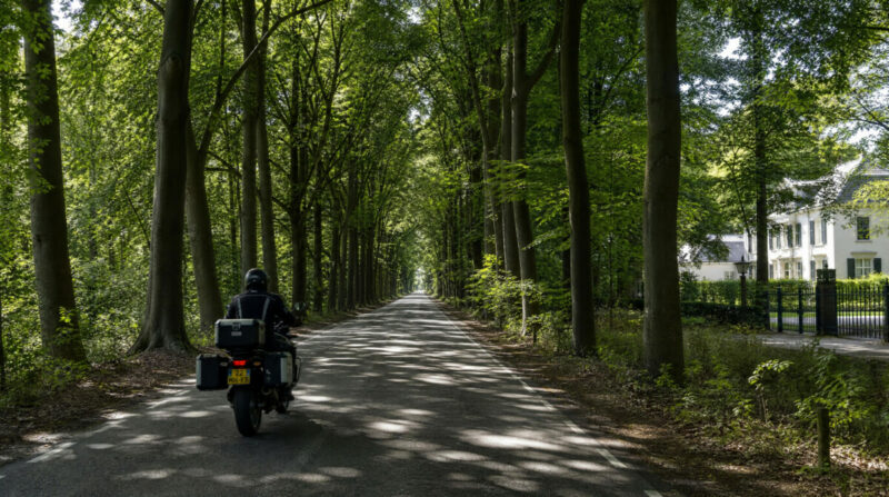
Utrechtse Heuvelrug
Ride southeast from Amersfoort toward Amerongen so you finish at the river. The forest cover means the road stays cool on hot days but also holds damp and leaf litter in the shaded stretches, so watch the surface in the tighter bends, especially in autumn. The estates along the ridge make natural stops: Kasteel Amerongen, where Kaiser Wilhelm II signed his abdication in 1918, and Museum Huis Doorn, where he lived in exile until his death in 1941 and where the interiors remain exactly as he left them. Traffic is light on weekday afternoons. Fuel is easy to find in Amersfoort, Doorn or Leersum.
Scenic tip
The ridge road connects loosely to the river roads along the Nederrijn and, further east, to the Veluwezoom loop above. Use Scenic’s Power Planner to chain the Heuvelrug ridge into a full day: it lets you drop waypoints at Amerongen and Rheden and builds a curvy route between them, turning two short rides into one proper afternoon rather than a single 26 km stretch.
Ride this route
Start (Amersfoort): 52.1561, 5.3878
Key point (Museum Huis Doorn): 52.0310, 5.3444
Key point (Kasteel Amerongen): 51.9953, 5.4587
End (Amerongen): 51.9987, 5.4590
Or get the whole route free here, with Scenic: https://scenicapp.space/route/qJQNNvvq
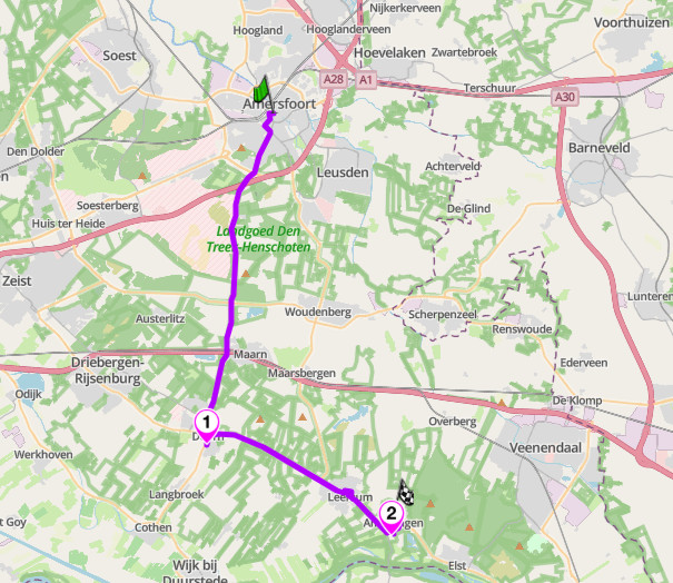
Utrechtse Heuvelrug: N225 / N227, Utrecht
5. The Maas River Route: N273, Limburg
Distance: 55 km loop (Roermond to Venlo via the west bank, returning via Steyl and Beesel on the east bank)
Best for: River touring, Maasland villages, relaxed day riding
Best time: April to October
The Route
The Maas is the river that shapes the eastern edge of Limburg, and this loop follows both its banks between Roermond and Venlo. The outward leg takes the N273, the old Napoleonsbaan, north through a string of ancient villages: Neer, where the bank rises and the river briefly opens out below; Kessel, one of the oldest settlements on the Maas, with the restored 9th-century Kasteel Keverberg above the water; and Baarlo, a castle village with four medieval castles of its own. The road is straight and well surfaced throughout. This is not technical riding. The interest is the villages rather than the road itself.
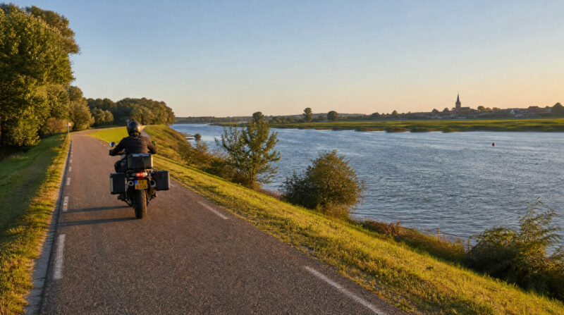
The Maas river, Limburg
Cross the Maas at Venlo and return south on the quieter east bank through Steyl, a monastery village founded by Father Arnold Janssen with three monasteries and a designated conservation area at its heart, then through Belfeld, Reuver and Beesel, the dragon village, before crossing back to Roermond. The east bank roads sit closer to the water than the N273 and carry far less traffic. The character of the two legs is quite different: the N273 is open and direct, the east bank roads are enclosed and unhurried. Together they make a complete day on the river. Fuel in Roermond or Venlo. Watch for agricultural traffic on the narrower east bank sections.
Scenic tip
The ferry crossing at Baarlo to Reuver runs seasonally and cuts the loop shorter if you want a tighter circuit. Check sailing times before you leave. If you ride the full loop, Steyl on the east bank is the natural stop: the monastery gardens are open to visitors and the village feels completely unlike anywhere else on this route.
Ride this route
Start / End (Roermond): 51.1942, 5.9875
Key point (Kessel, Kasteel Keverberg): 51.2909, 6.0561
Key point (Baarlo): 51.3310, 6.0908
Key point (Steyl): 51.3314, 6.1253
Or get the whole route free here, with Scenic: https://scenicapp.space/route/ObxZtkvl
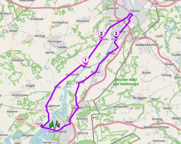
The Maas River Route: N273, Limburg
6. The Afsluitdijk: A7, Friesland to North Holland
Distance: 28 km (Kornwerderzand to Den Oever)
Best for: A landmark ride, decompression, engineering scale
Best time: Any clear day, spring to autumn
The Route
The Afsluitdijk is the most famous stretch of road in the country, and it is worth being honest about why. It is a 32 km causeway, part of the A7, running dead straight across open water from Friesland to North Holland. It closed off the old Zuiderzee in 1932 and turned a tidal inlet into the freshwater IJsselmeer, one of the largest engineering projects of its era. As a driving road it is a straight line. There are no corners. What it offers instead is a specific experience you cannot get anywhere else: riding for 20 minutes with the Wadden Sea on one side and the IJsselmeer on the other, water to both horizons, nothing but the dijk and the road. It is a decompression ride and a landmark. Do it once for what it is, not for the corners it does not have.
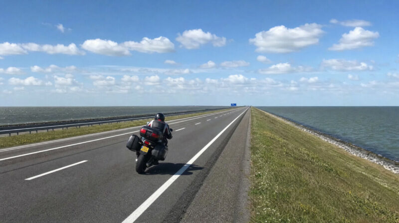
The Afsluitdijk
The dijk is fully exposed, and the crosswind here is the real story. With open water on both sides there is nothing to break it, and a strong westerly will push a bike hard across the lane the entire way. On a windy day this stops being a relaxed cruise and becomes a full-attention crossing, so check the forecast and hold a firm, deliberate line. There is a monument and viewpoint along the way near Breezanddijk where you can pull off. Fuel is available on the dijk itself, as well as at Den Oever and on the Friesland side. Pair it with the Frisian lake roads to the east or the North Holland coast to the west to build a full day, since the crossing alone is only 20 minutes.
Scenic tip
The Afsluitdijk is a straight line, so the value is in what you attach to either end. Use Scenic’s Power Planner to build the dijk into a longer loop: drop a waypoint on the crossing, then let it route you into the Frisian coast on one side and the North Holland coast on the other. The crossing becomes the centrepiece of a full day instead of a 20 minute dead end, and it links naturally to the Frisian lakes route further south.
Ride this route
Start (Kornwerderzand, Friesland): 53.0761, 5.3390
Midpoint (Breezanddijk monument): 53.0209, 5.2092
End (Den Oever, North Holland): 52.9345, 5.0370
Or get the whole route free here, with Scenic: https://scenicapp.space/route/fZzyNZsX
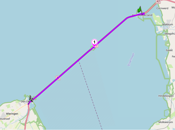
The Afsluitdijk: A7, Friesland to North Holland
7. The Oisterwijk Circuit, North Brabant
Distance: 64 km loop from Oisterwijk
Best for: Forest touring, quiet back lanes, abbey stop, a gentle half-day in the Brabant countryside
Best time: April to October
The Route
Brabant’s wooded interior is one of the most underridden parts of the Netherlands. The Oisterwijk Circuit links the forest and heathland reserves west of Tilburg in a single loop, using quiet back lanes throughout. The roads are narrow, tree-lined and almost entirely free of through traffic.
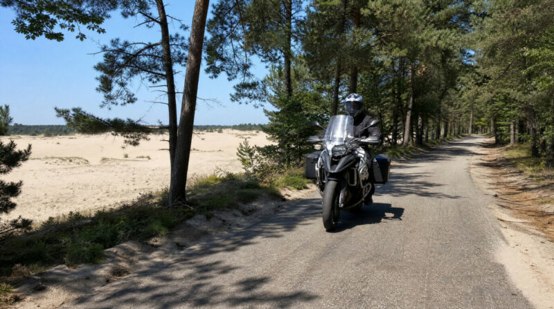
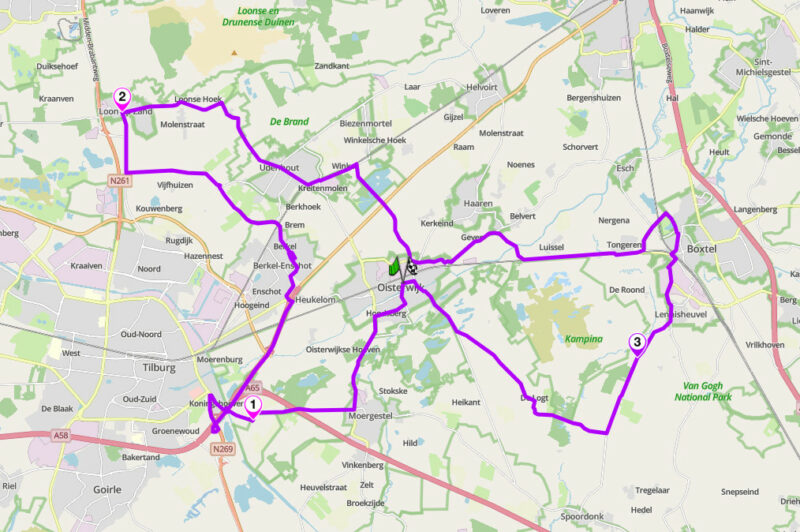
From Oisterwijk the route heads southwest through the Oisterwijkse Bossen en Vennen on forest back lanes to the Koningshoeven Abbey near Tilburg, where La Trappe Trappist beer has been brewed since 1884. The abbey café is the natural stop. From there the route continues northwest through Berkel-Enschot to Loon op Zand on the southern edge of the Loonse en Drunense Duinen, the largest active sand drift area in Western Europe. The dunes are not rideable but worth a short walk in from the nature gate if you have time. The return runs southeast via Udenhout and Boxtel through the Kampina heathland back to Oisterwijk. Flat throughout, light traffic, no technical demands.
Scenic tip
Ride out of Oisterwijk before 9am and the Bossen en Vennen feels genuinely remote: mist over the pools, minimal traffic. Download Scenic’s offline maps before you leave as phone coverage drops in the deeper forest sections.
Ride this route
Start / End (Oisterwijk): 51.5806, 5.1947
Key point (Koningshoeven Abbey): 51.5437, 5.1306
Key point (Loon op Zand): 51.6270, 5.0720
Key point (Kampina): 51.5602, 5.2965
Or get the whole route free here, with Scenic: https://scenicapp.space/route/shVNQCuN
The Oisterwijk Circuit, North Brabant
8. The Empty North: Groningen Coast
Distance: 69 km (Lauwersoog to Delfzijl)
Best for: Remote coastal riding, big skies, solitude
Best time: May to September
The Route
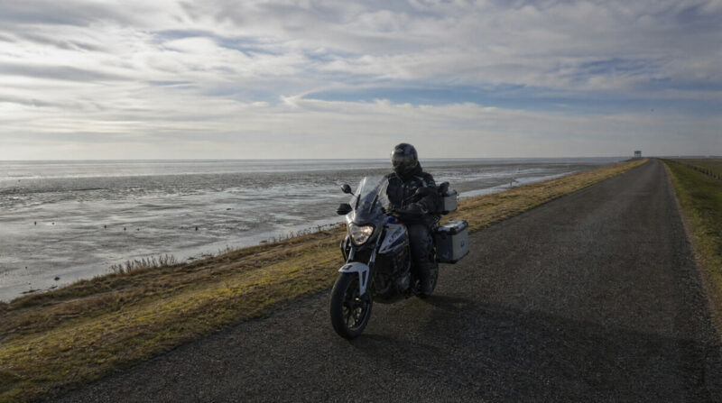
The far north of Groningen is the emptiest riding in the country. This route follows the sea dyke and minor coastal roads along the Wadden Sea, a UNESCO World Heritage tidal zone, from Lauwersoog east to Delfzijl. The landscape is stripped back to essentials: dyke, sea, sky, and the occasional church tower rising from a terp on the horizon. The terpen are the defining feature of this coast, man-made mounds built a thousand years ago to keep settlements above the flood water before the dykes existed. At low tide the Wadden mudflats stretch north for kilometres. There is almost no traffic. This is decompression riding at its most extreme, long straight and gently curving roads through a landscape that feels closer to Scandinavia than to the crowded Randstad two hours south.
The Groningen Coast
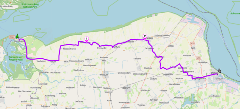
From Lauwersoog the road runs east along the coast through Pieterburen, home to the Seal Rescue Centre where dozens of rescued seals are rehabilitated before release. Continue to Uithuizen, where the 14th-century Menkemaborg castle sits just off the route and makes a natural stop. East of Uithuizen the coastal character gives way to the terpen landscape of the Groningen interior: minor roads threading between ancient mound villages past Westeremden and through Leermens to Delfzijl on the Eems estuary. Wind is the defining condition throughout, fully exposed and often strong off the sea in the western section, so pick a settled day. Fuel at Lauwersoog or in the larger villages. At Lauwersoog, the ferry to Schiermonnikoog, the car-free Wadden island, departs from the harbour if you want to extend the trip.
Scenic tip
Standard navigation will repeatedly try to pull you south onto faster inland roads away from the coast. Download the north for offline maps and set curvy routing to keep you on the dyke roads by the sea. With sparse signal and few landmarks up here, having the route held offline is what lets you commit to the empty coastal line rather than defaulting back toward the motorway.
Ride this route
Start (Lauwersoog): 53.4053, 6.2127
Key point (Pieterburen, Seal Centre): 53.4006, 6.4540
Key point (Uithuizen, Menkemaborg): 53.4089, 6.6781
End (Delfzijl): 53.3289, 6.9189
Or get the whole route free here, with Scenic: https://scenicapp.space/route/ZhGAaDZa
The Empty North: Groningen Coast
9. Frisian Coast and Gaasterland, Friesland
Distance: 63 km (Sneek to Workum via Gaasterland and the IJsselmeer coast)
Best for: Coastal dyke roads, the one wooded corner of the north, historic Frisian harbour towns
Best time: May to September
The Route
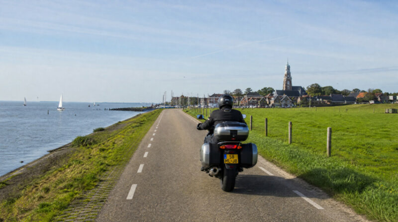
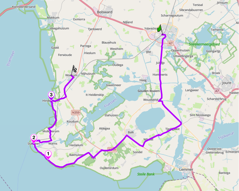
Friesland is water country, and this route rides its western edge. It starts in Sneek and runs southwest into Gaasterland, the one part of the province with real relief: a low, wooded, gently undulating landscape pushed up by Scandinavian glaciers, ending at the Rode Klif, a 10 m red cliff above the IJsselmeer shore. From there the route picks up the sea dyke north through the old Zuiderzee towns: Stavoren, the oldest city in Friesland founded around 300 BC, then Hindeloopen with its own dialect and painting tradition, finishing in Workum, where the Sint Gertrudis church is the largest late-Gothic church in the province and the preserved facades along De Noard are among the finest in Friesland.
Friesland
From Sneek head southwest through Sloten, the smallest of the Frisian eleven cities, before the road enters Gaasterland and the landscape changes character entirely. The narrow sea dyke from Rijs to Stavoren is the highlight of the coastal section: single track in places, shared with cyclists, with the IJsselmeer stretching west on your left and the farmland dropping away to the right. Ride it at a watchful pace. Wind off the lake is the defining condition on the exposed dyke, so pick a settled day. Fuel in Sneek or Stavoren. The Woudagemaal steam pumping station at Lemmer, the largest steam pumping station ever built and a UNESCO World Heritage Site since 1998, is worth the short detour south from Stavoren if time allows.
Scenic tip
Gaasterland is the part of this route most riders miss, heading straight for the coastal dyke without exploring the wooded lanes inland first. Set Scenic to curvy routing from Sneek and it pulls you through the forest roads around Oudemirdum and Rijs before delivering you to the dyke, rather than taking the direct road south. The two sections together, forest then coast, are what makes this route worth the trip north.
Ride this route
Start (Sneek): 53.0324, 5.6581
Key point (Gaasterland, Rode Klif): 52.8636, 5.3944
Key point (Stavoren): 52.8836, 5.3628
Key point (Hindeloopen): 52.9430, 5.3998
End (Workum): 52.9769, 5.4431
Or get the whole route free here, with Scenic: https://scenicapp.space/route/mKOhoCiF
Frisian Coast and Gaasterland, Friesland
10. Drenthe Backroads: Dwingelderveld and Hunebed Country
Distance: 45 km (Dwingeloo to Borger via Dwingelderveld)
Best for: Quiet heath and moor, prehistory, an underrated corner
Best time: May to September; late August for the heather
The Route
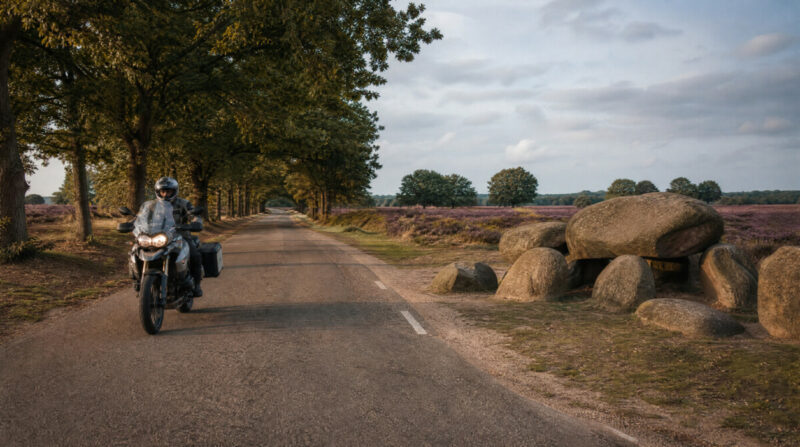
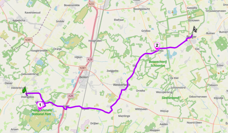
Drenthe is the province Dutch riders keep quiet about. It is the least crowded and most natural part of the mainland: endless forest, purple heath and village greens, with almost no through-traffic. This route runs from Dwingeloo through Dwingelderveld National Park, the largest remaining continuous wet heathland in Western Europe, then east along the Hondsrug ridge toward Borger and the hunebedden, the megalithic dolmens built here more than 5,000 years ago and the oldest monuments in the country. The roads are quiet, well surfaced and lined with oak, running between heath and woodland through old brink villages built around communal greens. Dwingeloo itself is worth a moment before you leave: the radio observatory on the edge of the village detected the first evidence of the Milky Way’s rotation in 1951.
Dwingelderveld and Hunebed Country
From Dwingeloo the route passes through the national park before picking up the minor roads east through Wijster, Eursinge and Elp. The section through Schoonloo follows part of the original TT circuit route, where the very first Dutch TT was run through the trees in the 1920s. The road still invites a certain pace through the long tree-lined straights. From Schoonloo the N374 carries you into Borger, where the Hunebedcentrum sits beside the largest dolmen in the Netherlands. There are dozens more scattered across the surrounding fields. Weekdays are near empty throughout. Watch for wildlife on the wooded stretches at dawn and dusk. Fuel in Dwingeloo or Borger.
Scenic tip
Late August is the month to come. The heather across the Dwingelderveld turns purple and the low morning light through the trees on the approach to Schoonloo is at its best in the first hours after sunrise. Drenthe rewards an early start and a slow pace. Download Scenic’s offline maps before you leave: signal drops in the deeper forest sections and the back lane junctions are easy to misread without navigation.
Ride this route
Start (Dwingeloo): 52.8354, 6.3658
Key point (Dwingelderveld National Park): 52.8124, 6.3992
Key point (Schoonloo): 52.9055, 6.7006
End (Borger, Hunebedcentrum): 52.9296, 6.7926
Or get the whole route free here, with Scenic: https://scenicapp.space/route/MndypjOd
Drenthe Backroads: Dwingelderveld and Hunebed Country
Planning Your Ride
Where to base yourself
Middelburg is the natural base for the Zeeland delta: the Oosterscheldekering and Brouwersdam are both within 30 minutes. Valkenburg is the obvious choice for the Limburg Heuvelland, with hotels and facilities geared toward riders and the heuvelland lanes on the doorstep. Rheden or Dieren put you close to Kasteel Biljoen and the Veluwezoom for the Gelderland route. Amersfoort covers the Utrechtse Heuvelrug with easy access east toward the Veluwezoom for a two-day combination. Roermond sits at the southern end of the Maas loop. For the Afsluitdijk, stay on either side of the crossing: Harlingen on the Frisian side or Den Helder on the North Holland side. Sneek is the right base for the Frisian coast route. Lauwersoog has limited accommodation; Groningen city is the practical base for the northern coastal route. Dwingeloo or Borger work equally well for the Drenthe backroads.
Honourable mentions
Two routes that narrowly missed the top ten are worth knowing. The Sallandse Heuvelrug in Overijssel is the other glacial ridge worth riding: lower than the Veluwezoom but less visited, with the Holterberg and Nijverdal area offering a compact loop of forest roads and heath. The Achterhoek region east of Doetinchem, near the German border, gives you 160 km of hedgerow country, castle estates and minor roads through one of the greenest and least-known corners of the Netherlands. Both reward a visit if you have already covered the main ten.
Frequently asked questions
What is the best time of year for motorcycle riding in the Netherlands? May to September gives the most reliable weather and the widest window of daylight. Late April and October are excellent for emptier roads with better light. The Zeeland delta and the Afsluitdijk ride well outside summer if the weather is settled. The Limburg heuvelland is good from April through October. Avoid the Zeeland barriers and the Wadden coast in strong westerly winds regardless of season.
Do any of these routes have speed cameras or restrictions? The Veluwezoom national park enforces speed limits strictly and closes some roads to motor traffic at certain times. The Zeeland barriers and the Afsluitdijk are part of the national road network with standard enforcement. Limburg Heuvelland roads carry a 40 mph equivalent limit on the open country lanes and are policed on summer weekends.
Are there toll roads on any of these routes? The Netherlands has no motorcycle tolls on any of the routes in this guide. The Afsluitdijk is a free crossing. Some Zeeland tunnels carry tolls for cars but motorcycles are generally exempt or charged at a lower rate. Check current rates before you ride.
Which route is best for an adventure bike? The Drenthe backroads and the Groningen coastal route suit adventure touring setups well: long distances, quiet roads, limited fuel stops and the kind of remote character that rewards a bike with range. The Veluwezoom park section also suits an adventure bike given the enforced slow pace and the forest road character.
Which routes work best for riders based in Amsterdam? The Utrechtse Heuvelrug is 45 minutes southeast and works well as a half-day. The Afsluitdijk is an hour north and pairs naturally with a run along the North Holland coast. The Veluwezoom is around 90 minutes east. For a longer commitment, the Limburg Heuvelland is around 2.5 hours south and worth planning a full weekend around.
How do I use Scenic for route planning in the Netherlands? Set your start and end points, adjust the curviness slider upward, and download offline maps for the region before departure. Signal is unreliable on the Wadden coast, across the Veluwezoom and in the deeper forest sections of Drenthe and Brabant. For the Zeeland delta and Friesland, curvy routing keeps you on the dyke roads and coastal N-roads rather than defaulting to the faster inland routes. For Limburg, the Round Trip feature from Valkenburg builds a loop automatically that takes in the best valley lanes without any manual route planning.
The Netherlands has more good roads than its reputation suggests. Pick your region, plan your loop, and go.
Scenic Premium gives you turn-by-turn navigation with curviness routing that finds roads like these automatically, global offline maps so you are covered when signal disappears on the coast or in the forest, and a rider-focused display designed for a helmet visor glance. Plan your next Netherlands ride at scenic.app. Use code Premium15 for 15% off your first year.
If you go, tag us and use the hashtag #ridewithscenic for your chance to win a free Scenic t-shirt.
You have made it to the end of the article. At Scenic we like to reward people who plan their trips properly. If you are not already a premium member, use this code to get 15% off your first year of Scenic Premium: Premium15


