
 Southern France has more good riding per square kilometre than almost anywhere in Europe. The best motorcycle roads in southern France span three distinct landscapes: the high Alps with paved passes above 2,700 m, the limestone plateaus of Provence cut through by deep gorges, and the Cote d’Azur where red volcanic rock meets the sea. Motorcycle touring in southern France runs from technical Alpine hairpins to fast coastal sweepers, and the riding season stretches from spring on the coast to high summer on the passes. This guide covers 10 routes that define motorcycle riding in southern France, with verified road numbers, distances, altitudes and GPS coordinates for each. Pick a base, plan a loop, and go.
In this guide:
Contents
1. Col de la Bonette: D64, Alpes-Maritimes
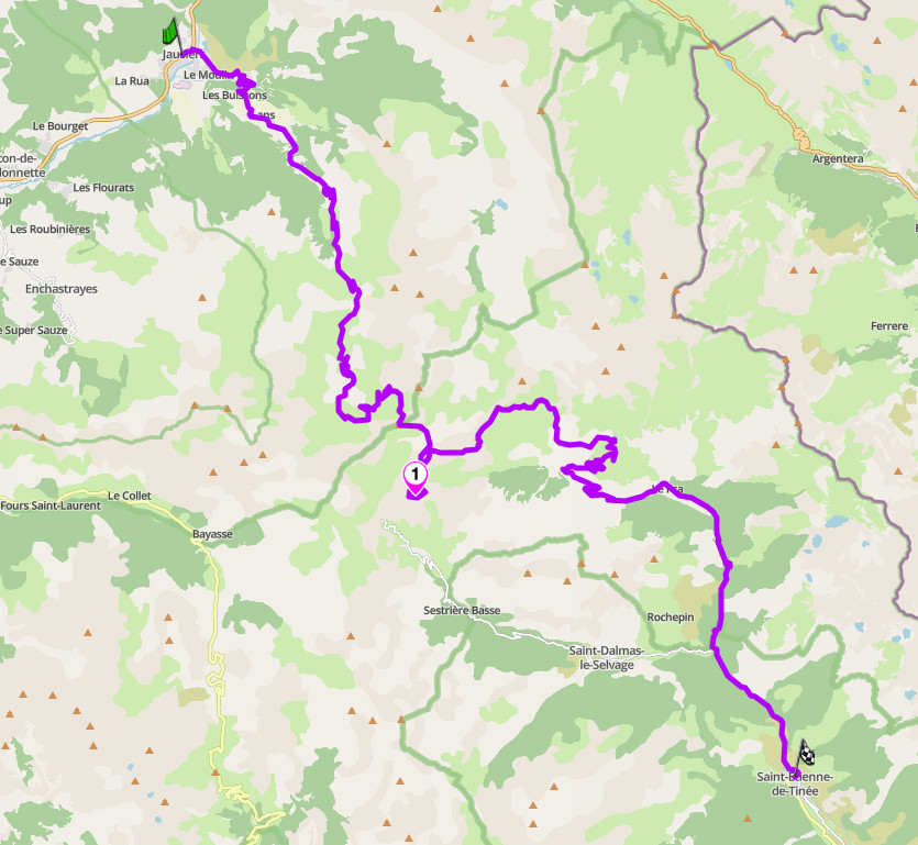
Distance: 49 km (Jausiers to Saint-Etienne-de-Tinee)
Altitude: 2,715 m (pass); 2,802 m (Cime de la Bonette loop)
Best for: epic Alpine riding, high-altitude challenge, remote wilderness
Best time: June to September (road opens late May, closes October)
The Route:
The D64 over the Col de la Bonette connects the Ubaye valley to the Tinee valley through the Mercantour National Park. The pass sits at 2,715 m, but a two-kilometre loop branches off at the top to circle the Cime de la Bonette at 2,802 m, the highest paved point in the French Alps. The road began as an 18th-century military route, was classified imperial under Napoleon III in 1860, and entered Tour de France history in 1962. From Saint-Etienne-de-Tinee it climbs 1,658 m over 26 km at an average of 6.4 per cent; the Jausiers side gains 1,589 m over 24 km. Neither approach is technically brutal. The challenge is altitude: much of the final third runs above 2,000 m, in a national park where the weather turns without warning. What you get for it is the highest through-road in the country and a summit loop that feels closer to the moon than to Provence.
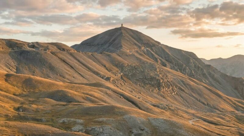
Col de la Bonette
Ride north to south, Jausiers to Saint-Etienne-de-Tinee. This puts the most barren, dramatic terrain under you on the climb and keeps the best valley scenery for the descent. Leave Jausiers by 9am in summer to reach the summit before the moto traffic and paragliders come up from the south. Fuel at Jausiers before you start; there is nothing on the mountain, and the seasonal cafe partway up cannot be relied on. The Cime loop hits 16 per cent at its steepest, with raised surface ridges that will unsettle a bike carrying speed, so take it slow. From July the road runs through active grazing zones and sheep move freely on the tarmac. The pass closes for winter, usually by late October. Check inforoute04.fr or inforoutes06.fr before any late-season attempt.
Scenic tip:
Mobile signal disappears for long stretches above Saint-Etienne-de-Tinee and across the Mercantour. Download the area with Scenic’s Go offline feature before you leave the valley, so turn-by-turn keeps running at the summit and on the descent into the Tinee. On a mountain where the weather can force a fast change of plan, having the map held offline is what lets you reroute without signal.
Ride this route:
Start (Jausiers): 44.4172, 6.7286
Summit (Cime de la Bonette): 44.3211, 6.8064
End (Saint-Etienne-de-Tinee): 44.2558, 6.9247
Or get the whole route free here, with Scenic: https://scenicapp.space/route/LjvpyNqq
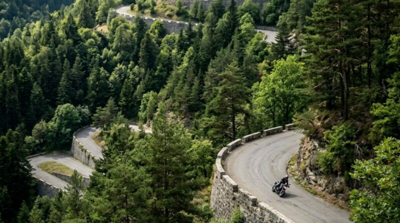
Col de la Bonette: D64, Alpes-Maritimes
2. Col de Turini: D2566, Alpes-Maritimes
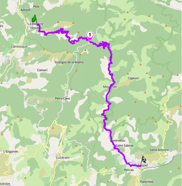
Distance: 36 km (La Bollene-Vesubie to Sospel)
Altitude: 1,607 m (pass)
Hairpins: numerous, tightly stacked (La Bollene approach)
Best for: technical riding, rally history, tight hairpin sequences
Best time: April to November
The Route:
The Col de Turini is the technical benchmark of the southern Alps, and the reason is the west side. From La Bollene-Vesubie the M70 and D2566 stack a dense sequence of hairpins up the mountainside in a few kilometres, tight enough that the road has featured for decades in the Monte Carlo Rally, run at night, in winter, at speed. The pass tops out at 1,607 m in forest, and the descent toward Sospel opens into faster, more flowing corners. This is not a high-altitude epic like the Bonette. It is a driving road: a compact, relentless test of throttle and brake control that riders come to the region specifically to tick off. It sits within easy reach of the coast, which makes it the natural first target for anyone based around Nice.
Col de Turini
Ride the hairpins as the climb, not the descent: go La Bollene-Vesubie to Sospel so you take the tight stacked section uphill, where it is easier to place the bike and read the corners. The tarmac is generally good but the forest sections hold damp and leaf litter in the shade, so watch the surface on cool mornings. Traffic is heaviest on summer weekends, when other bikes, cyclists and cars all converge on the pass; a weekday ride is far cleaner. Fuel at Sospel or down in the Vesubie valley before you climb. The pass connects north to the Vesubie and the approaches to the Bonette, so it slots naturally into a longer Mercantour loop.
Scenic tip:
Turini is the anchor for a full day, not a road to ride once and leave. Use Scenic’s Explore feature from Sospel or La Bollene: set a distance and direction, and it builds a curvy loop that strings Turini together with the surrounding Vesubie and Bevera valley roads rather than sending you back the way you came. This is exactly the kind of hub-and-spoke terrain the feature is built for.
Ride this route:
Start (La Bollene-Vesubie): 43.9910, 7.3305
Summit (Col de Turini): 43.9789, 7.3919
End (Sospel): 43.8792, 7.4453
Or get the whole route free here, with Scenic: https://scenicapp.space/route/oWZCfYMd
Col de Turini: D2566, Alpes-Maritimes
3. Gorges du Verdon, Route des Cretes: D23 / D71, Alpes-de-Haute-Provence
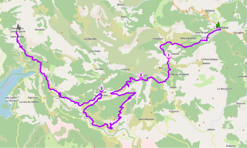
Distance: 45 km loop (La Palud-sur-Verdon, both rims)
Best for: canyon scenery, technical rim riding, a full day out
Best time: May to October
The Route:
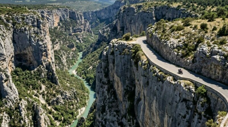
The Gorges du Verdon is the largest river canyon in Europe, and the riding starts before you reach the rim. A few kilometres out of Castellane the road narrows through the Clue de Chasteuil, where the cliffs lean out over the tarmac and the exhaust note bounces straight back off the limestone. From there the D952 runs to Point Sublime, a mandatory ten-minute leg stretch with dedicated bike parking and a short walk to a viewpoint looking straight down the jaws of the canyon. The centrepiece is the D23 Route des Cretes, which loops out from La Palud-sur-Verdon along the north rim past a string of belvederes. This is the crown jewel: tight first and second-gear switchbacks, sheer 700-metre drops separated from your tyres by a low stone curb, and wild mountain goats that stand in the apex of the corners. On the south side the Corniche Sublime, the D71, traces the opposite rim with the canyon’s most famous long views. Ride it for the scenery and the technical challenge, not for pace.
Gorges du Verdon
Ride the D23 clockwise, heading east out of La Palud-sur-Verdon: the middle 15 km is strictly one-way in this direction and the belvederes line up on your side of the road. Go early. The car parks fill through the morning in summer and the road becomes a slow procession of tourist traffic by midday. The surface is sound but the drops are unguarded, so ride within yourself and stop at the laybys rather than sightsee on the move. After the D23 loop returns you to La Palud, continue northwest on the D952 toward Moustiers: the road clings to the cliff face and the turquoise Lac de Sainte-Croix opens up ahead. Fuel at Castellane or Moustiers-Sainte-Marie before you start, as options around the canyon are limited.
The other side of the canyon, the D71, is an amazing road in its own right, with views of what you just rode, but you’ll have to discover that one for yourself.
Scenic tip:
Finish at Moustiers-Sainte-Marie, one of the most beautiful villages in France, built into a cliffside split by a waterfall with a golden star strung on a chain between the two cliffs above the town. Park the bikes, strip the gear, and take a table near the Place de l’Eglise for a cold pression or a lavender lemonade. The village is known for its faience pottery and its gelato, and a steep stone staircase climbs to the Notre-Dame de Beauvoir chapel for a view back over the valley. Time it for the end of the day and ride out at sunset.
Ride this route:
Start (Castellane): 43.846047, 6.512790
Photo Spot (Point Sublime): 43.7897, 6.3819
Mid Point (La Palud-sur-Verdon): 43.7756, 6.3389
End (Moustiers-Sainte-Marie): 43.8456, 6.2214
Or get the whole route free here, with Scenic: https://scenicapp.space/route/zKahwVrz
Gorges du Verdon
4. Route Napoleon: N85, Alpes-Maritimes to Isere
Distance: 333 km (Golfe-Juan to Grenoble)
Key passes: Col des Leques (1,146 m), Col Bayard (1,246 m)
Best for: multi-day touring, historic road, changing terrain
Best time: May to October
The Route:
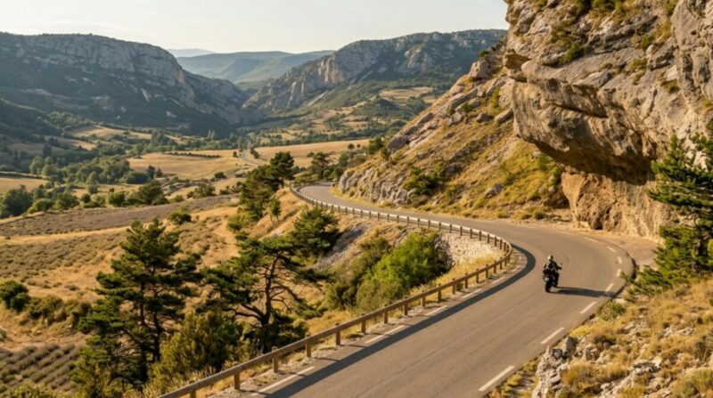
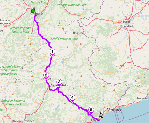
The Route Napoleon follows the path Napoleon took in March 1815 on his return from Elba, running 333 km from the Mediterranean at Golfe-Juan to Grenoble in a continuous sweep north through the Alps. It is one of the longest dedicated touring roads in France, marked by the imperial eagle the whole way. The terrain changes character four times: Riviera hillsides above Grasse, pre-Alpine limestone from Grasse to Castellane, the Provencal plateau between Digne and Sisteron, and true Alpine ground from Gap north to Grenoble. The best riding is the stretch from Digne-les-Bains south through Castellane down to Grasse: roughly 120 km of fast, flowing mountain road through the Clue de Taulanne and over the Col des Leques. Multiple rider sources single out the Digne-to-Grasse section as the fastest and most rewarding part.
Route Napoleon
Ride it north to south, Grenoble to Golfe-Juan, so the route builds in intensity toward the coast. The northern section from Grenoble to Gap is pleasant but wide and fast. The Gap-to-Sisteron stretch shadows the A51 motorway; many riders prefer the D900 via Selonnet and Digne instead, a similar distance on a better road. From Digne south the route becomes proper riding: tree-lined, fast-dropping, consistently curved, with the Clue de Taulanne gorge south of Barreme as its most distinct passage. Fuel at Gap, Digne and Castellane. The Castellane-to-Grasse section is the busiest and the best; if it is all you ride, the journey was worth it. Allow two days for the full route to see anything beyond the tarmac.
Scenic tip:
The whole point of the Route Napoleon is to avoid the motorway, but ask a standard satnav to get you from Grenoble to the coast and it will put you straight on the A51 and A8. Plan the route in Scenic with the curvy setting on and drop a via point at Digne-les-Bains, and it holds you on the N85 and the better D900 alternative rather than defaulting to the toll road. For a route this long, that is the difference between a day’s ride and a two-hour transit.
Ride this route:
Start (Grenoble): 45.1885, 5.7245
Midpoint (Digne-les-Bains): 44.0921, 6.2361
End (Golfe-Juan): 43.5636, 7.0781
Or get the whole route free here, with Scenic: https://scenicapp.space/route/ZgdfnAfr
Route Napoleon: N85, Alpes-Maritimes to Isere
5. Mont Ventoux: D974, Vaucluse
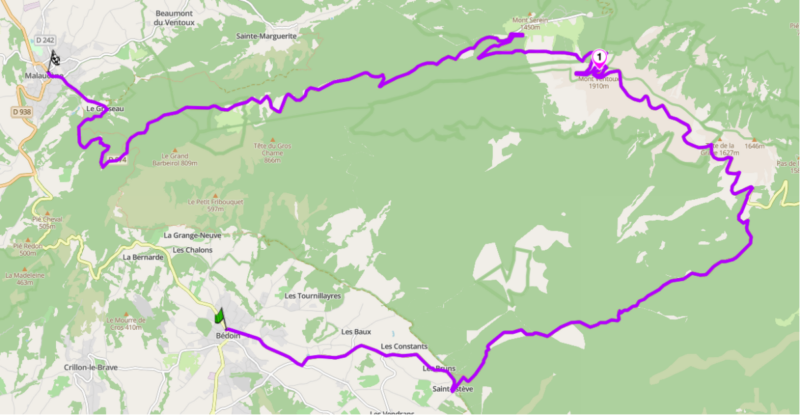
Distance: 22 km climb (Bedoin to summit); 43 km full traverse (Bedoin to Malaucene)
Altitude: 1,910 m (summit)
Best for: iconic climb, lunar summit landscape, a benchmark tick
Best time: mid-May to mid-November (summit road closed in winter)
The Route:
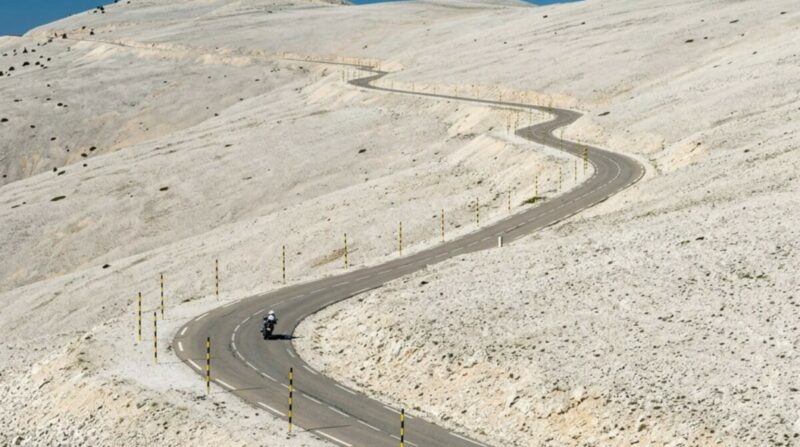
Mont Ventoux stands alone above the Provencal plain, the highest point in the region at 1,910 m and visible for miles in every direction. Known as the Beast of Provence, it is geologically part of the Alps but rises isolated from them, which is what gives the D974 climb its character. From Bedoin the road climbs 1,598 m over 21.8 km at an average of 7.5 per cent, with sections at 15, running through open vineyards and orchards, then a long merciless stretch of forest, and finally out into the bare white limestone of the summit, a lunar field of scree with the observatory tower on top. The road up from Malaucene on the north side is a similar length and better sheltered from the wind. Ventoux is famous through the Tour de France, and the Tom Simpson memorial sits a kilometre below the summit. As a ride it is a benchmark: not the most technical road in the region, but one every rider in Provence wants to have done.
Mont Ventoux
Climb from Bedoin for the classic ascent and descend to Malaucene to make a traverse rather than an out-and-back. The mountain earns its name: Ventoux means windy, and the summit is one of the windiest places in France, with the exposed Col des Tempetes just below the top closed outright in high wind. Check the forecast before you commit, and carry a layer, since the temperature at the summit can sit fifteen degrees below the valley. Ride early on a weekday to miss the cyclists, who are on this road in numbers all season. Fuel at Bedoin or Malaucene; there is nothing on the climb but the seasonal cafe at Chalet Reynard. The summit road is closed through winter, roughly mid-November to mid-May.
Scenic tip:
The three ascents, Bedoin, Malaucene and Sault, each have a different character, and the good day rides all three or links two into a loop through the villages below. Use Scenic’s Plan feature to build a loop that climbs one side and descends another, dropping via points at Bedoin and Malaucene so the route makes a full circuit of the mountain rather than a there-and-back. It turns a single climb into a day.
Ride this route:
Start (Bedoin): 44.1236, 5.1794
Summit (Mont Ventoux): 44.1741, 5.2786
End (Malaucene): 44.1758, 5.1322
Or get the whole route free here, with Scenic: https://scenicapp.space/route/YUHKQrpl
Mont Ventoux: D974, Vaucluse
6. Col d’Izoard: D902, Hautes-Alpes
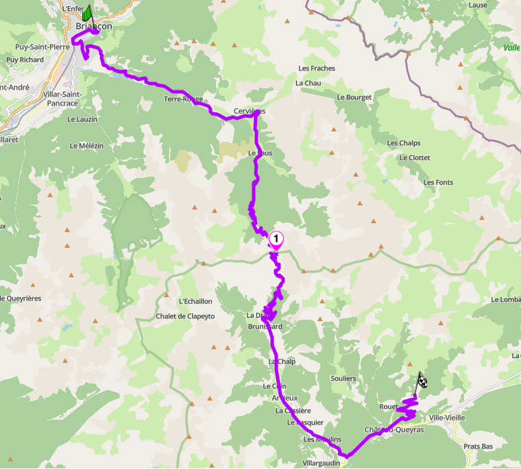
Distance: 41 km (Briancon to Chateau-Ville-Vieille)
Altitude: 2,360 m (pass)
Best for: distinctive Alpine scenery, the Casse Deserte, technical climbing
Best time: June to October (closed in winter)
The Route:
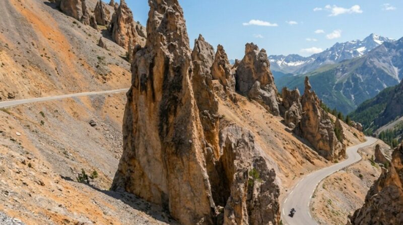
The Col d’Izoard rises to 2,360 m between Briancon and the Queyras, and it is included here for one section that looks like nowhere else in the Alps: the Casse Deserte on the southern side. Below the pass the forest falls away into a field of shattered scree and eroded rock pinnacles, a barren moonscape the road threads through on a narrow shelf. The D902 climbs to it through pine forest from the north out of Briancon, and drops through the Casse Deserte to the south toward Arvieux and the Queyras. The pass has deep Tour de France history and a monument to the riders Coppi and Bobet stands at the exit of the Casse Déserte, just before the final two kilometres to the summit. As a road it is a proper Alpine climb, well surfaced and consistently curved, but it is the strangeness of the terrain near the summit that makes it worth the detour off the main Route des Grandes Alpes.
Col D’Izoard
Ride south from Briancon so the Casse Deserte comes as the descent, opening up in front of you as you drop out of the trees. Leave early to have the desert section to yourself; it is a known photo stop and fills with cars and cyclists by late morning in summer. The surface is good but the shelf road through the scree is narrow with little margin, so keep speeds in check where the walls close in. Fuel at Briancon before the climb. The Izoard connects naturally into a wider day: drop into the Queyras from the south, take the D205T up to the Col Agnel at 2,744 m for the views over Mont Viso, retrace to Château-Ville-Vieille, and return to Briançon through the Gorges du Guil. The pass closes in winter, typically late October to early June.
Scenic tip:
The Casse Deserte is best in the low, hard light of early morning or the last hour before sunset, when the eroded pinnacles throw long shadows across the scree and the rock warms to orange. Most riders pass through at midday when the light is flat and the place looks grey. Time your run through the southern side for the golden hour and stop at the Coppi-Bobet monument for the classic view down through the desert.
Ride this route:
Start (Briancon): 44.8994, 6.6431
Summit (Col d’Izoard): 44.8203, 6.7350
End (Chateau-Ville-Vieille): 44.7696, 6.8033
Or get the whole route free here, with Scenic: https://scenicapp.space/route/HSpkedYY
Col d’Izoard: D902, Hautes-Alpes
7. Gorges de l’Ardeche: D290, Ardeche
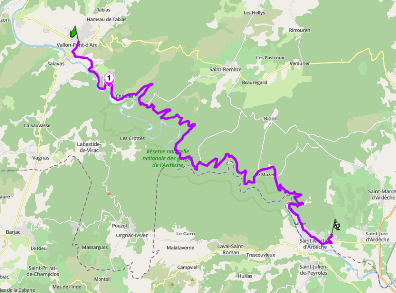
Distance: 40 km (Vallon-Pont-d’Arc to Saint-Martin-d’Ardeche)
Best for: non-Alpine canyon touring, cliff-top viewpoints, warm-season riding
Best time: April to October
The Route:
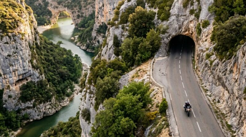
The Gorges de l’Ardeche gives the article its western anchor and a completely different character from the Alps. The D290 runs the northern rim of the Ardeche canyon for 30 km from Vallon-Pont-d’Arc to Saint-Martin-d’Ardeche, opening at its western end at the Pont d’Arc, a huge natural stone arch the river has cut through the rock. The road tracks the cliff top the whole way, with a long series of belvederes looking down several hundred metres to the green river and the canoes on it far below. It is a touring road rather than a technical one: flowing, well surfaced, punctuated by viewpoints, and set in warm limestone country far enough south to ride comfortably outside the Alpine season. It links naturally into the wider Ardeche and the roads around the Cevennes for a longer trip.
Gorges de l’Ardeche
Ride west to east from Vallon-Pont-d’Arc so you start at the Pont d’Arc and follow the canyon downstream. The road is busiest in high summer, when the Ardeche is one of the most popular holiday regions in France and the canyon fills with cars and canoe traffic; spring and autumn are far quieter and the riding is better for it. The viewpoints are frequent and worth stopping at, so ride this one to look rather than to push. Fuel at Vallon-Pont-d’Arc or Saint-Martin-d’Ardeche at either end. The lower-altitude setting makes this a strong choice for early or late in the year when the passes are shut.
Scenic tip:
The Pont d’Arc at the western end is the highlight, and the best time to see it is early, before the canoe crowds put onto the water and the car park below fills. Ride out from Vallon-Pont-d’Arc in the first hour after sunrise, stop at the arch, then take the rim road with the canyon to yourself. The natural arch over the river is the shot the whole route is known for.
Ride this route:
Start (Vallon-Pont-d’Arc): 44.4014, 4.3906
Highlight (Pont d’Arc): 44.3830, 4.4159
End (Saint-Martin-d’Ardeche): 44.3006, 4.5697
Or get the whole route free here, with Scenic: https://scenicapp.space/route/ZITxVGyY
Gorges de l’Ardeche: D290, Ardeche
8. Corniche de l’Esterel: D559, Var
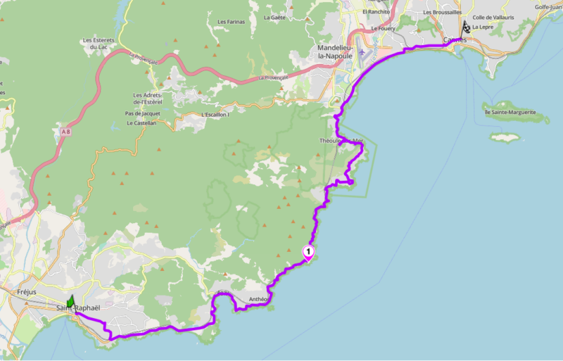
Distance: 42 km (Saint-Raphael to Cannes)
Best for: coastal riding, red rock scenery, year-round season
Best time: all year, best outside July and August
The Route:
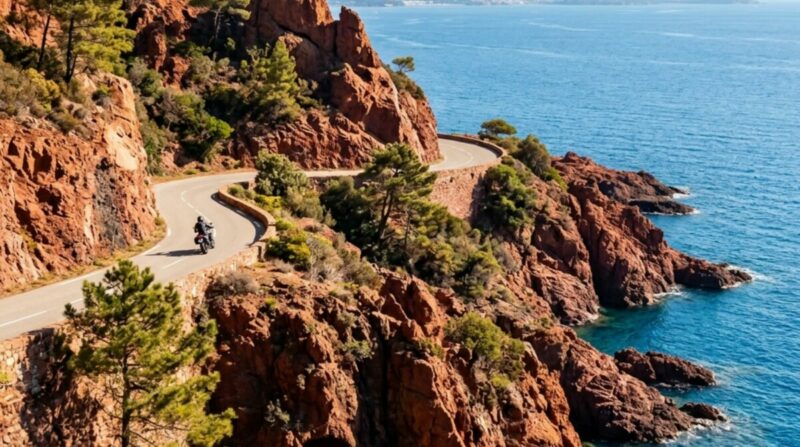
The Corniche de l’Esterel is the coastal counterweight to the Alpine passes, and the only route here you can ride comfortably in midwinter. The D559 and D6098 run the coast for 30 km from Saint-Raphael to Cannes, hugging the shoreline of the Esterel massif where the red volcanic rock, the roche rouge, drops straight into the blue Mediterranean. The road is a constant sequence of bends around headlands and small calanque inlets, with the water on one side and the porphyry cliffs on the other. It is not a fast road and not meant to be. It is a flowing coastal cruise through the most striking stretch of the Cote d’Azur coastline, with a colour contrast of red rock and blue sea. It makes a natural bookend to a trip that starts or finishes on the coast.
Corniche de l’Esterel
Ride west to east from Saint-Raphael toward Cannes, or the reverse; the coast is the point in either direction. Avoid July and August if you can, when the Cote d’Azur traffic turns the corniche into a slow crawl and the small parking pull-offs fill by mid-morning. Outside high summer, early on a weekday, it is a clear and lovely ride. The many small coves and viewpoints make good stops, and the road is easy and well surfaced throughout. Fuel is easy to find at either end. Because it stays low and coastal, this route rides all year, which makes the Esterel the answer when the passes are under snow and you still want a good day out.
Scenic tip:
The small pull-offs along the corniche, the Pointe de l’Observatoire among them, sit right above the water where the red rock meets the sea, and late afternoon light turns the porphyry a deep orange against the blue. It is a coastline made for stopping. Ride it slowly, pick a pull-off on the seaward side, and time it for the last hours of the day when the colour is at its best.
Ride this route:
Start (Saint-Raphael): 43.4247, 6.7681
Highlight (Pointe de l’Observatoire): 43.4490, 6.9186
End (Cannes): 43.5528, 7.0174
Or get the whole route free here, with Scenic: https://scenicapp.space/route/MGXqGLzR
Corniche de l’Esterel: D559, Var
9. Col d’Allos: D908, Alpes-de-Haute-Provence
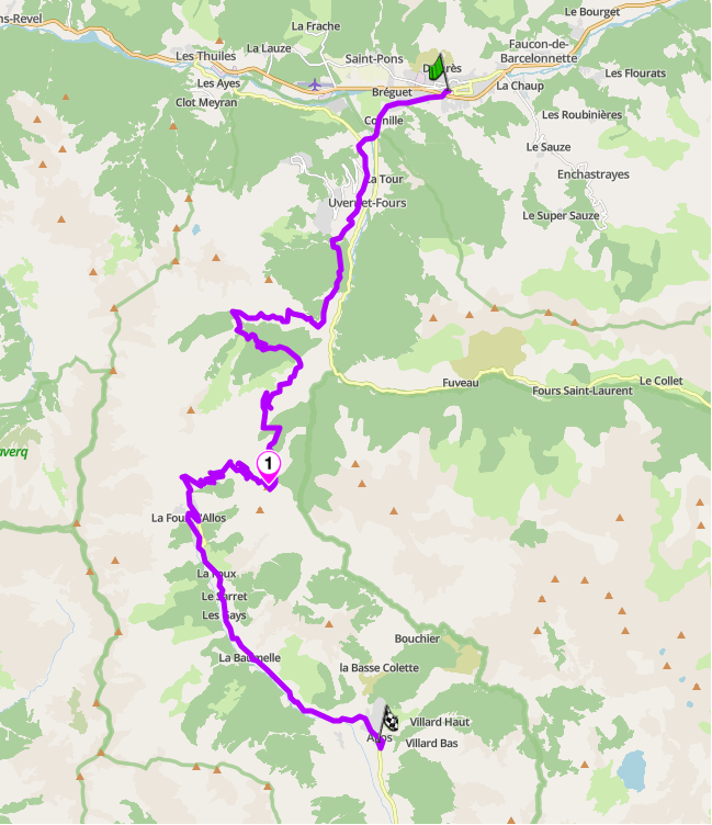
Distance: 35 km (Barcelonnette to Allos)
Altitude: 2,250 m (pass)
Best for: underrated Alpine pass, narrow shelf riding, fewer crowds
Best time: June to October (closed in winter)
The Route:
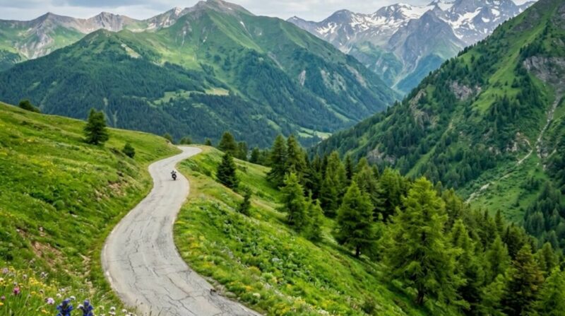
The Col d’Allos is the underrated pass on this list, and the one that gives it long-tail authority. The D908 climbs to 2,250 m between Barcelonnette in the Ubaye and the Verdon headwaters near Allos, and it stays largely off the main Route des Grandes Alpes circuit, which keeps it quiet. The road is narrow, without much in the way of barriers, and runs as a shelf across open mountainside with long drops to the valley floor. That character, exposed, unguarded, demanding constant attention, is exactly what makes it rewarding for riders who want a pass with no tourist coaches on it. It connects the Ubaye valley to the upper Verdon and slots into a loop with the Bonette or the Cayolle for a full day in the high southern Alps. It is proper mountain riding without the traffic of the famous names.
Col d’Allos
Ride south from Barcelonnette toward Allos and the Verdon, so the exposed shelf section climbs ahead of you. The road is single-track in places with limited passing room, so ride to your sightlines and be ready to give way, particularly to descending traffic on the tighter sections. The surface is reasonable but can be rough at the edges, so stay off the very margin where the drop is unguarded. Fuel at Barcelonnette before the climb. The pass closes in winter, typically late October to early June, so confirm it is open before an early or late-season visit. Pair it with the Bonette for a high Ubaye loop that stays away from the busiest roads.
Scenic tip:
The Col d’Allos gives its best view north from just below the summit on the Barcelonnette side, where the shelf road stacks back down the open mountainside and the Ubaye valley opens out behind. Most riders are watching the road here, and rightly, but the pull-off near the top is worth the stop. Ride up in the morning light, park at the summit, and walk back a few metres for the drop down the exposed face you have just climbed.
Ride this route:
Start (Barcelonnette): 44.3861, 6.6522
Summit (Col d’Allos): 44.2983, 6.5938
End (Allos): 44.2394, 6.6289
Or get the whole route free here, with Scenic: https://scenicapp.space/route/PvEIQGqa
Col d’Allos: D908, Alpes-de-Haute-Provence
10. Gorges du Daluis: D2202, Alpes-Maritimes
Distance: 12 km (Daluis to Guillaumes)
Best for: short highlight ride, red rock gorge, an unknown road
Best time: April to October
The Route:
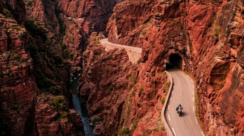
The Gorges du Daluis is the least-known road here and the reason the list has authority. The D2202 runs 12 km up a narrow gorge between Daluis and Guillaumes where the rock is a deep red, the same deep red rock as the Esterel coast but here cut vertically by the Var into a tight canyon. The road is a shelf carved into the red cliff, threading short unlit tunnels and clinging to the rock face above the river, with low walls and little margin. It is short, so it is included as a highlight rather than a full day’s ride, but it is one of the most distinctive twelve kilometres in the southern Alps and almost nobody rides it, because no pass connects it to the main Alpine touring network. If you want a road other riders on the same trip have not found, this is it.
Gorges du Daluis
This is 12 km of the reddest, strangest gorge in the region. Plan the rest of the day around it. Ride north from Daluis to Guillaumes so the gorge climbs alongside the river. For a longer day, start further south at Entrevaux – its fortified old town on the Var is worth the stop – and ride the D4202 north to Daluis before entering the gorge. From Guillaumes, continue east toward Valberg or link north to the Var valley roads rather than retracing south. The gorge road is narrow with short tunnels and cliff faces close to the edge, so ride it with full attention. Fuel at Guillaumes or Entrevaux; there is nothing in the gorge itself.
Scenic tip:
The Daluis is almost never crowded because it sits off the standard Route des Grandes Alpes itinerary and no pass connects it to the main touring network. That is the whole appeal. If you are in the Var or Ubaye and want a road the other bikes on your route have not ridden, this is the one to seek out; ride the gorge slowly and stop where it opens to look up at the red walls.
Ride this route:
Start (Daluis): 44.0245, 6.8106
End (Guillaumes): 44.0841, 6.8559
Or get the whole route free here, with Scenic: https://scenicapp.space/route/zadBkXzy
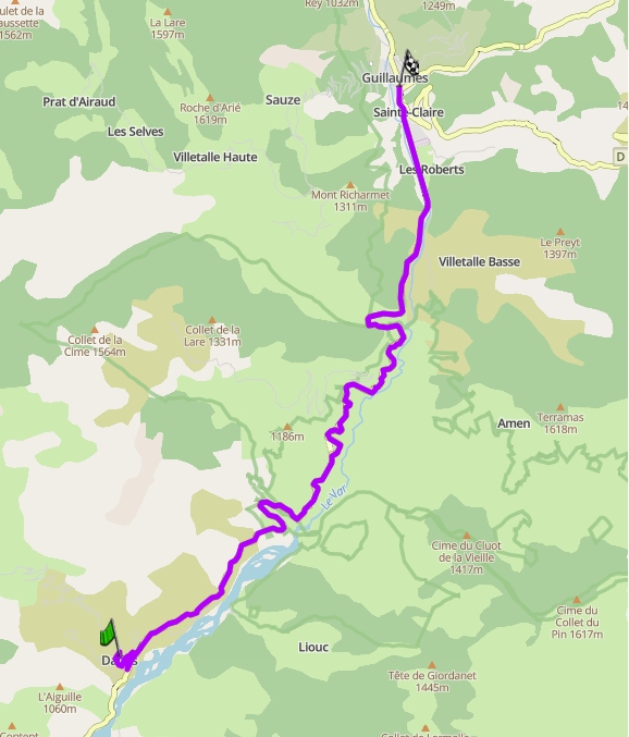
Gorges du Daluis: D2202, Alpes-Maritimes
Planning Your Ride
The riding season in southern France splits by altitude. The high Alpine passes, the Bonette, the Izoard, the Allos and the summit of Ventoux, generally open between late May and early June and close again from late October, depending on snowfall. The lower routes, the Esterel, the Ardeche, the Verdon and the Daluis, ride from spring through autumn, and the coastal Esterel rides all year. If you are planning early or late in the season, confirm the passes are open before you commit. Check inforoute04.fr and inforoutes06.fr for the Alpes-de-Haute-Provence and Alpes-Maritimes passes, and note that Ventoux and the high cols can close at short notice in bad weather regardless of the calendar.
French law requires motorcycle headlights on at all times. You must carry a high-visibility vest and put it on if you stop on the road outside a built-up area, though you do not need to wear it while riding. There is no general toll for motorcycles on the open roads in this guide, but the autoroutes are tolled and extensive in the Rhone corridor and along the coast. The routes here are all toll-free, and choosing the N85 Route Napoleon over the A51 and A8 costs time but saves money and is a far better ride. Fuel is the main practical constraint in the mountains: on the Bonette, Izoard, Allos and Ventoux, the last fuel is usually 20 to 25 km below the summit, so fill up in the last town before you climb.
For a region this large and varied, offline navigation matters. Mobile signal drops out across the Mercantour and on most of the high passes, and Scenic’s Go offline feature keeps turn-by-turn running where there is no coverage. It is worth downloading your regions before you head into the mountains.
Where to base yourself
Barcelonnette anchors the northern passes, with the Bonette, the Allos and the Cayolle all radiating from the Ubaye valley. Castellane or La Palud-sur-Verdon put you at the centre of the Verdon and within reach of the best of the Route Napoleon. Nice is the base for Turini and the Esterel, close to the coast and the southern end of the Mercantour. Briancon anchors the high Hautes-Alpes for the Izoard and the Queyras. For Ventoux and the west, Bedoin or Malaucene sit at the foot of the mountain.
Frequently asked questions
When is the best time to ride in southern France? June to September for the high Alpine passes, when they are reliably open and clear of snow. Spring and autumn are better for the lower routes and the coast, with quieter roads and comfortable temperatures.
When do the Alpine passes open? Most high passes, including the Bonette, Izoard and Allos, open between late May and early June and close from late October, depending on snowfall. Confirm on inforoute04.fr or inforoutes06.fr before an early or late visit.
Is the Col de la Bonette the highest road in France? The Cime de la Bonette summit loop at 2,802 m is the highest paved point in the French Alps. The through-pass itself sits at 2,715 m, the highest paved through-road in the country.
Do I need a high-visibility vest to ride in France? You must carry one and wear it if you stop on the road outside a built-up area. You do not need to wear it while riding. Headlights must be on at all times.
Can I ride in southern France in winter? Yes, on the coast. The Corniche de l’Esterel and the lower Provence and Ardeche roads ride all year. The high passes and the Ventoux summit are closed by snow from roughly November to May.
Are the roads tolled? The routes in this guide are toll-free. The autoroutes (A8, A51) are tolled, but every road recommended here avoids them.
Southern France has more good roads than any single trip can cover. Pick your region, plan your loop, and go.
For any of these routes, we recommend Scenic Premium. It gives you turn-by-turn navigation built for riders, a customisable rider-focused display, global offline maps for the high passes where signal disappears, and automatic curvy routing that finds the mountain road rather than the valley shortcut. For a region this large, it is the most efficient way to build loops instead of point-to-point lines.
If you go, tag us and use the hashtag #ridewithscenic for your chance to win a free Scenic t-shirt.
You’ve made it to the end of the article! At Scenic we like to reward people who plan their trips properly. If you’re not already a premium member, use this code to get 15% off your first year of Scenic Premium: ScenicBlog20


