
The Best Motorcycle Roads in Norway: Top 10 Routes
The best motorcycle roads in Norway share one design constraint: the landscape refused to cooperate. Fjords cut the coastline into fragments, so the roads climb over instead of around. The result is a country built for motorcycle touring. Norway packs hairpin walls, high plateaus above the treeline, and island-hopping causeways into distances you can ride in a season. This guide covers the ten best routes for motorcycle riding in Norway, with distances, coordinates, pass opening dates, and the practical details that make each one work.
In this guide:
1. The Golden Route: Trollstigen and Geiranger: Fv63, Møre og Romsdal
Distance: 129 km (Åndalsnes to Geiranger, including the Dalsnibba spur)
Altitude: 1,476 m (Dalsnibba)
Hairpins: 11 (Trollstigen wall), 11 (Ørnevegen descent)
Key passes: Trollstigen plateau (approx. 850 m), Dalsnibba (1,476 m)
Best for: Hairpin technique, fjord views, a full riding day in one route
Best time: Mid June to August
The Route:
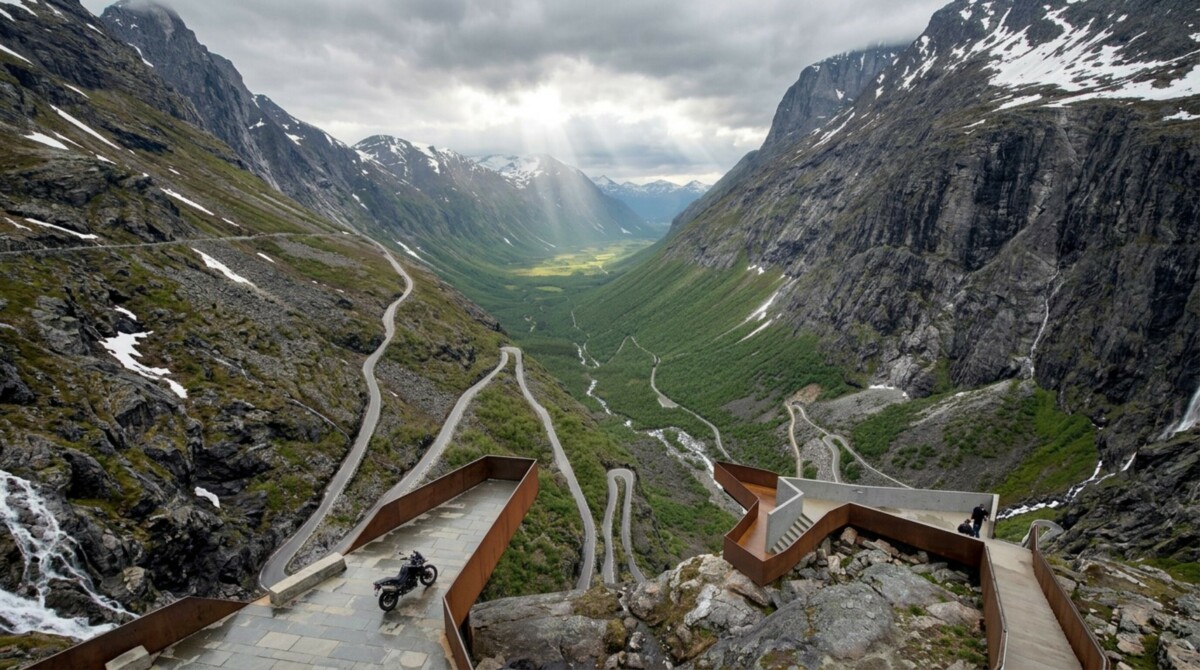
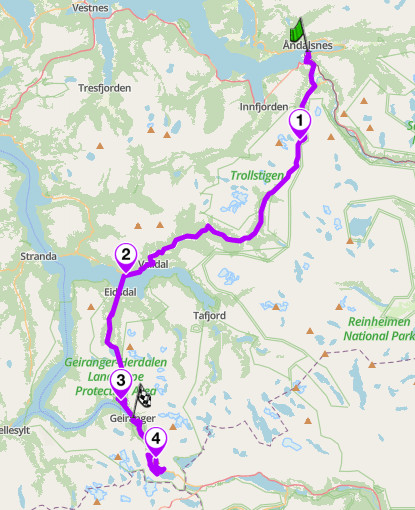
Fv63 is the road most riders picture when they think of Norway. It opened in 1936 after eight years of construction, and the Trollstigen section still reads as a dare: eleven hairpins stacked up a mountain wall, crossing the Stigfossen waterfall on a stone bridge partway up. From the plateau the road runs south through Valldal, crosses Norddalsfjord on the Linge to Eidsdal ferry, climbs over a second ridge, and drops into Geiranger down the Ørnevegen, the Eagle Road, with the fjord and the Seven Sisters waterfall below. The Dalsnibba spur at the southern end climbs the Nibbevegen toll road to 1,476 m, the highest fjord view in Europe you can reach on tarmac.
Status note: Trollstigen was closed for extended periods in 2024 and 2025 while crews carried out rockfall protection work. That work is now done, and the road returned to a normal full season in 2026, opening in late April with no major restrictions planned. Short closures during heavy rain remain possible, since the road closes temporarily whenever rockfall risk rises, so check the Norwegian Public Roads Administration (vegvesen.no) or the Scenic app for current status before committing to the northern approach. If the wall section is ever closed, the Geiranger half of the route still justifies the trip.
Rider logic:
Ride it south from Åndalsnes. You climb the Trollstigen wall rather than descend it, which puts the drops behind you and the sightlines ahead. Start before 08:00. The tour buses arrive from mid morning and they take the full width of the hairpins. Fuel and coffee in Åndalsnes before you leave; the Trollstigen visitor centre on the plateau has a café in season. Valldal is the mid-route stop, known for strawberries in July. The Linge to Eidsdal ferry runs every 30 minutes or so in summer and takes 10 minutes; no booking, ride to the front of the queue. In Geiranger, fuel and cafés sit at the fjord head. The full route is open roughly mid May to October depending on snow; the Nibbevegen toll road to Dalsnibba opens around late May. Watch for wet rock seepage on the Trollstigen wall even in dry weather, and for buses cutting the apex on the Ørnevegen hairpins.
Scenic tip:
The Dalsnibba climb is a spur, not a through-road. You’ll ride back down the same Nibbevegen tarmac to rejoin the main route before continuing on to Geiranger. Worth knowing before you commit to the detour, since it adds more time and distance than a glance at the map suggests.
Ride this route:
Start (Åndalsnes): 62.5586, 7.7080
Trollstigen plateau: 62.4825, 7.6476
Ferry (Linge): 62.3059, 7.1910
Ørnesvingen viewpoint: 62.1214, 7.1728
Summit (Dalsnibba): 62.0511, 7.2687
End (Geiranger): 62.1009, 7.2059
Or get the whole route free here, with Scenic: https://scenicapp.space/route/YdcvzrDT
The Golden Route: Trollstigen and Geiranger — Fv63, Møre og Romsdal
2. Atlantic Ocean Road: Fv64, Møre og Romsdal
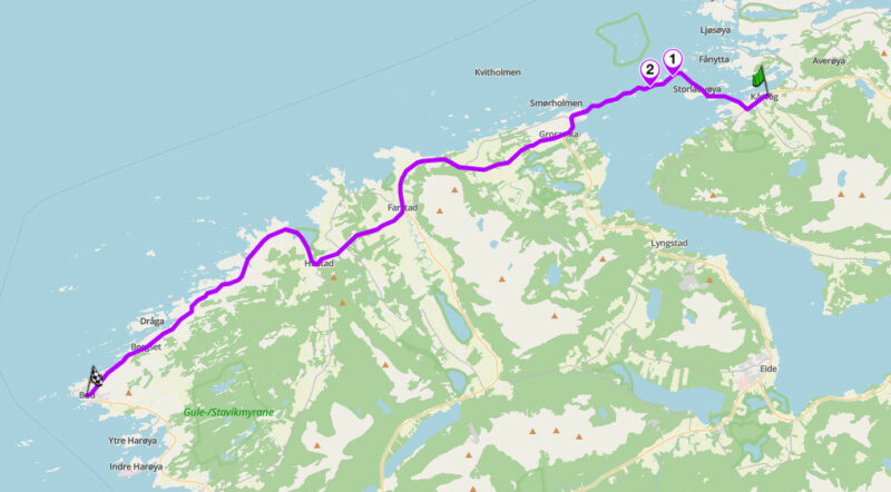
Distance: 35 km (Kårvåg to Bud)
Best for: Coastal riding, bridge photography, low-effort spectacle
Best time: May to September; September for drama
The Route:
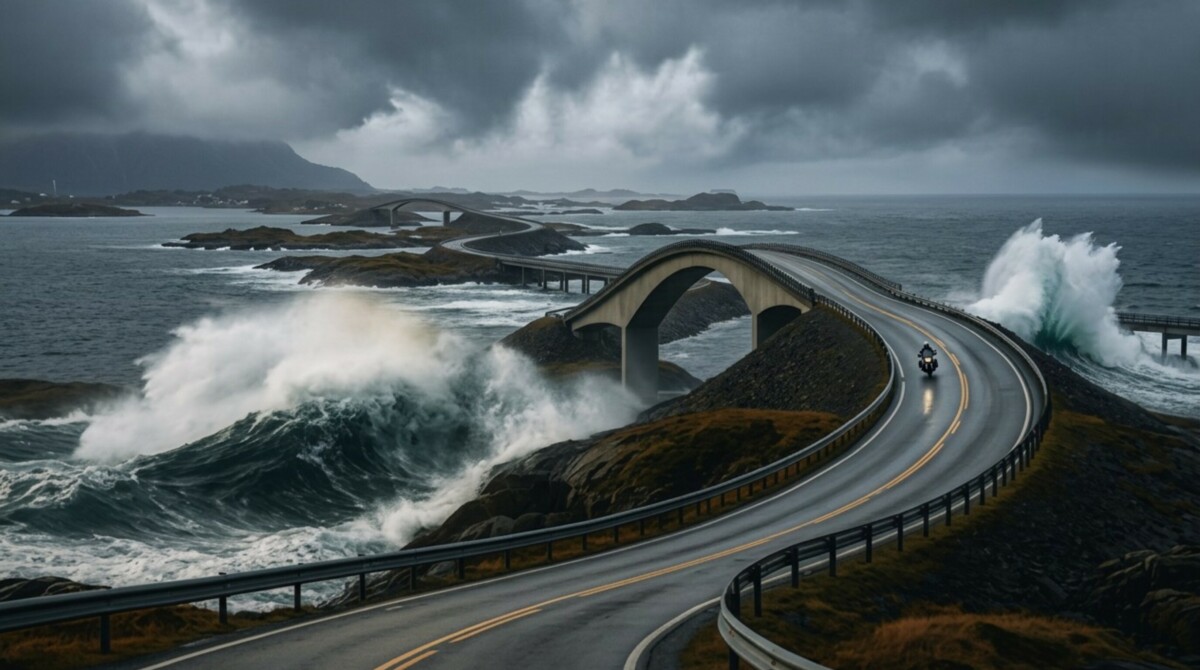
The Atlantic Ocean Road is a golden stretch case. The famous section is 8 km long: a chain of causeways and low bridges hopping between skerries at the exact line where Norway meets open sea. Storseisundet Bridge is the centrepiece, a cantilever that appears to launch into nothing until the road twists mid-span. Eight kilometres is not a ride, so the route builds it into a proper coastal day: start in Kårvåg on Averøy, cross the bridges, then follow Fv64 and the coastal road south through fishing villages to Bud, a working harbour town with cafés and a fort from the Second World War. The middle section is why you came. The rest keeps the sea on your right shoulder the whole way.
Atlantic Ocean Road
Rider logic:
Ride it north to south. Crossing Storseisundet southbound puts the famous curve ahead of you rather than in your mirrors. This road rewards bad weather more than most: on calm days it is pleasant, in a September blow the waves break over the causeways and the ride becomes something you will not repeat elsewhere. Do not stop on the bridges; use the built parking at Eldhusøya, which has a café in season. Fuel in Kårvåg or at Vevang. Bud has cafés and fish restaurants at the harbour. The road is open year round and toll free. Crosswinds are the hazard: the bridges funnel gusts, so expect a shove at each crest.
Scenic tip:
Walk the Eldhusøya loop. A 700 m elevated walkway circles the islet next to Storseisundet Bridge and gives the only angle where you can shoot the bridge’s full curve with the ocean behind it. Ten minutes on foot, and the photograph most riders miss because they stop at the roadside pull-ins instead.
Ride this route:
Start (Kårvåg): 63.0139, 7.4498
Eldhusøya: 63.0210, 7.3720
Storseisundet Bridge: 63.0170, 7.3550
End (Bud): 62.9075, 6.9141
Or get the whole route free here, with Scenic: https://scenicapp.space/route/spPUcsPe
Atlantic Ocean Road — Fv64, Møre og Romsdal
3. Sognefjellsvegen: Fv55, Innlandet and Vestland
Distance: 108 km (Lom to Gaupne)
Altitude: 1,434 m
Key passes: Sognefjellet (1,434 m)
Best for: High-mountain touring, glacier views, long flowing sections
Best time: June to September
The Route:
Fv55 over Sognefjellet is the highest mountain pass road in Northern Europe. It began as a trade route; farmers from the fjord carried salt and fish over the mountain to exchange for iron and butter, and the modern road was built by hand in 1938 as an unemployment relief project. From Lom, a stave-church town and one of the best food stops in the Norwegian mountains, the road climbs steadily into Jotunheimen, passing the Smørstabbreen glacier and the Hurrungane peaks. Above the treeline it runs for kilometres across bare rock and snowfields, past Sognefjellshytta at the summit plateau, then descends to Turtagrø and drops in earnest to Skjolden at the head of Lustrafjorden. The final leg follows the fjord shore to Gaupne. One road, three climates.
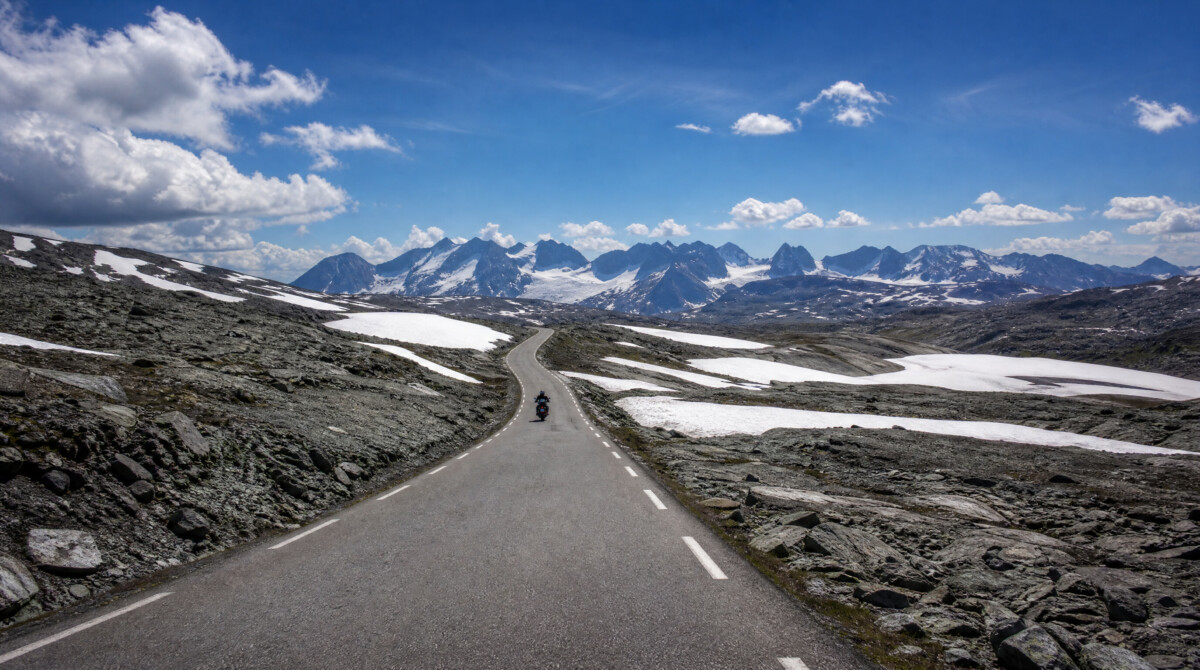
Sognefjellsvegen
Rider logic:
Ride it east to west, Lom to Gaupne. The descent to Skjolden is the highlight and it is better going down, with the fjord filling the view. The pass typically opens in May and closes with the first serious snow in October or November; early season riders pass between snow walls. Fuel in Lom and Gaupne; there is no fuel over the mountain, so start full. Coffee at Sognefjellshytta on the summit plateau or at Turtagrø Hotel, a climbers’ base since 1888. Temperature drops of 15 degrees between Lom and the summit are normal, so pack the liner even in July. Sheep are on the road above the treeline. The descent to Skjolden includes tight, steep corners with gravel wash after rain.
Scenic tip:
Stop at Nedre Oscarshaug, a stone-ringed viewpoint on the western descent with a sighting tube that names each of the Hurrungane peaks in front of you. It is a small lay-by and easy to pass at speed. This is the best free view in Jotunheimen, and at 07:00 you will have it alone.
Ride this route:
Start (Lom): 61.8382, 8.5667
Summit (Sognefjellet, Fantesteinen area): 61.5621, 7.9870
Nedre Oscarshaug: 61.5087, 7.8106
Turtagrø: 61.5044, 7.8044
Skjolden: 61.4909, 7.6002
End (Gaupne): 61.4113, 7.2848
Or get the whole route free here, with Scenic: https://scenicapp.space/route/uFZuWpuD
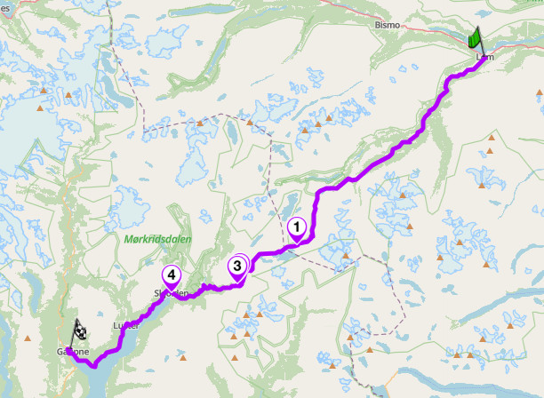
Sognefjellsvegen — Fv55, Innlandet and Vestland
4. Aurlandsfjellet Snow Road: Fv243, Vestland
Distance: 48 km (Aurlandsvangen to Lærdalsøyri)
Altitude: 1,306 m
Key passes: Aurlandsfjellet (1,306 m)
Best for: High-plateau atmosphere, the Stegastein viewpoint, escaping the tunnel
Best time: June to September (typically open June to mid October)
The Route:
When the Lærdal tunnel opened in 2000, the world’s longest road tunnel at 24.5 km, the old mountain road over Aurlandsfjellet lost its transport purpose and became something better: a road with no reason to exist except the riding. Locals call it Snøvegen, the Snow Road, because snowbanks line it into July. From Aurlandsvangen the road climbs in tight ramps above Aurlandsfjord, past the Stegastein viewpoint, a 30 m wooden platform hanging 650 m above the water. Above Stegastein the landscape empties out. The plateau is bare rock, meltwater pools, and a single-track ribbon of tarmac through what looks like the far side of the moon. The descent to Lærdal winds down through birch forest to one of Norway’s best-preserved old town centres.
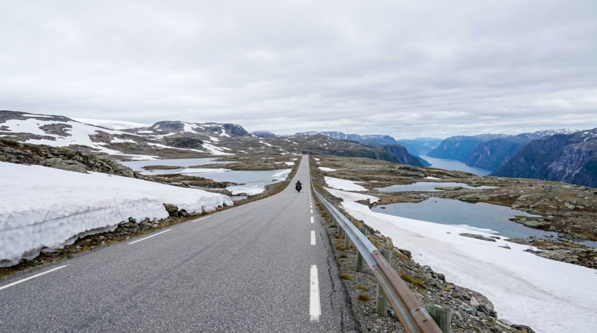
Aurlandsfjellet Snow Road
Rider logic:
Ride it from Aurlandsvangen to Lærdalsøyri. Climbing from the fjord side means the Stegastein stop comes early, before the viewpoint car park fills, and the plateau opens ahead of you at the top. Much of the plateau section is single track with passing places; speed is not the point of this road. It typically opens in June, later than the big passes, because clearing the drifts takes time. Fuel and cafés in both Aurlandsvangen and Lærdalsøyri; nothing in between. Fog can sit on the plateau while both valleys are clear, so check the webcams before climbing. Watch for campervans reversing badly at passing places.
Scenic tip:
Any standard navigation app will send you through the Lærdal tunnel: 24.5 km of dead-straight bore, which is an experience of a kind but not the one you rode to Norway for. Turn on curvy routing in Scenic and the routing engine takes Fv243 over the top by default. This is the clearest case in Norway where the shortest route and the right route are different roads.
Ride this route:
Start (Aurlandsvangen): 60.9071, 7.1884
Stegastein: 60.9108, 7.2120
End (Lærdalsøyri): 61.0988, 7.4803
Or get the whole route free here, with Scenic: https://scenicapp.space/route/WiEDeBWA
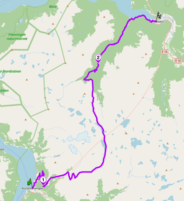
Aurlandsfjellet Snow Road — Fv243, Vestland
5. Gamle Strynefjellsvegen: Fv258, Innlandet and Vestland
Distance: 65 km (Grotli to Stryn via Videsæter)
Altitude: 1,139 m
Key passes: Strynefjellet, old summit (1,139 m)
Best for: Gravel heritage riding, adventure bikes, riding into the 1890s
Best time: June to September (gravel section typically open early June to October)
The Route:
Gamle Strynefjellsvegen is the adventure entry on this list, and the history is the point. The road opened in 1894 after 10 years of hand construction, and the 32 km old section between Grotli and Videsæter is preserved close to its original state: a narrow gravel road lined with hand-set stone guard blocks and marker cairns, crossing the mountain the way roads did before dynamite got cheap. This is the golden stretch. Either side, tarmac carries you in from Grotli, a high mountain lodge on Rv15, and out from Videsæter down Hjelledalen to Stryn, a fjord town with every amenity. The middle section is why you came: snowfields into July, waterfalls falling directly beside the roadway, and a surface that asks for attention rather than speed.
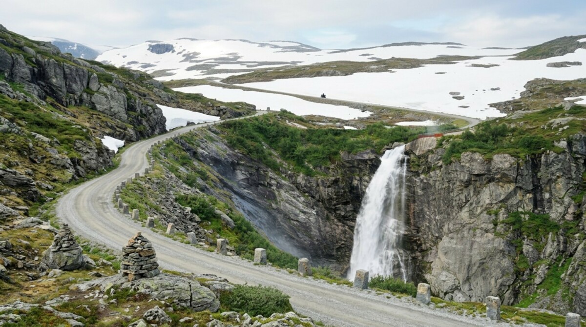
Gamle Strynefjellsvegen
Rider logic:
Ride it west, Grotli to Stryn, so the long descent finishes at the fjord. The gravel is well graded and fine on any bike ridden calmly; road bikes on touring tyres manage it every summer, but adventure bikes are in their element. Allow more time than 32 km suggests. Fuel at Grotli and in Stryn; nothing on the old road. The Videsæter hotel at the western end has coffee and one of the best terrace views in Vestland, straight down Hjelledalen. The old road typically opens in early June. Meltwater runs across the surface in early season and the stone edge blocks are the only barrier, so keep speeds honest. If the weather closes in, Rv15 runs parallel through tunnels as a bail-out.
Scenic tip:
At the summit, stop at the Strynefjell summer ski centre turn-off and look back east: the road you just rode is visible as a thin grey line across the snowfields, guard stones and all, essentially unchanged from photographs taken in 1900. Early morning gives the best light on the western descent, when the sun is still behind you and Hjelledalen is lit end to end.
Ride this route:
Start (Grotli): 62.0139, 7.6320
Videsæter: 61.9325, 7.2249
End (Stryn): 61.9061, 6.7232
Or get the whole route free here, with Scenic: https://scenicapp.space/route/ZWZJRBKo
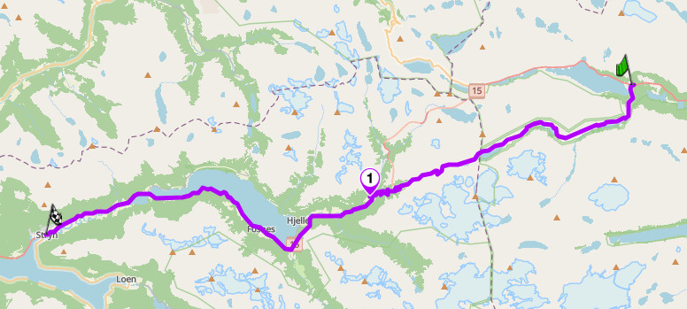
Gamle Strynefjellsvegen — Fv258, Innlandet and Vestland
6. Valdresflye: Fv51, Innlandet
Distance: 123 km (Fagernes to Randen)
Altitude: 1,389 m
Key passes: Valdresflye (1,389 m)
Best for: Fast flowing riding, Jotunheimen views, decompression days
Best time: June to September (high section opens around April, weather permitting)
The Route:
Valdresflye is Norway’s second-highest pass road and its best flowing ride. Where Trollstigen is a technical exercise, Fv51 is rhythm: long open curves climbing from Fagernes through Beitostølen, then out onto a high plateau with the Jotunheimen massif filling the western horizon. The road runs above the treeline for more than 20 km, past the reindeer herds that graze the plateau, before dropping past Gjendesheim, trailhead for the Besseggen ridge hike, and descending the long valley to Randen on Rv15. Traffic is light, sightlines are long, and the surface is good. This is the road for the day after Trollstigen, when your concentration wants a rest and your bike does not.
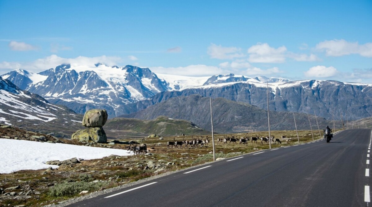
Valdresflye
Rider logic:
Ride it south to north, Fagernes to Randen, saving the plateau for the second half. Beitostølen is the last proper stop before the high section, with fuel and cafés. Gjendesheim has a lodge café in season. The high section is kept open from around Easter for the ski-touring trade, earlier than any comparable pass, which makes Valdresflye the best early-season high ride in Norway. Reindeer cross without ceremony: if you see one, there are twenty. Speed enforcement on Fv51 is real, and Norwegian fines scale with income, so save the enthusiasm for the corners rather than the straights.
Scenic tip:
Fagernes sits on the E16 and Fv33, with Fv51 heading north into the plateau, making it a natural hub for extending the day in either direction. Riders with time to spare can treat Valdresflye as one leg of a longer loop rather than an out-and-back.
Ride this route:
Start (Fagernes): 60.9858, 9.2319
Beitostølen: 61.2486, 8.9054
Gjendesheim: 61.4894, 8.8396
End (Randen, Rv15 junction): 61.8502, 9.0109
Or get the whole route free here, with Scenic: https://scenicapp.space/route/MEuRnhdz
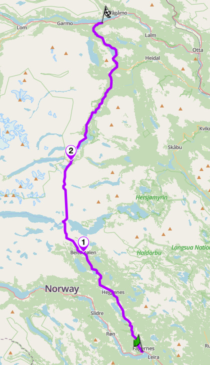
Valdresflye — Fv51, Innlandet
7. Lysevegen: Fv500, Rogaland
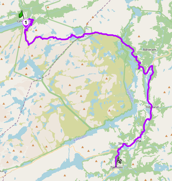
Distance: 50 km (Lysebotn to Tjørhom, Sirdal)
Altitude: 932 m
Hairpins: 27 (Lysebotn wall)
Best for: Hairpin technique, the tunnel hairpin, southern Norway’s biggest climb
Best time: Late May to September
The Route:
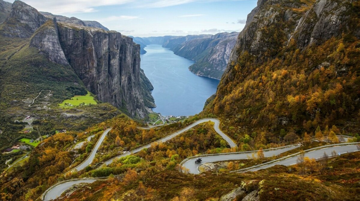
Lysevegen exists because a power company needed access to the head of Lysefjord, and the only way out was up. The result is southern Norway’s answer to Trollstigen: 27 hairpins climbing roughly 900 vertical metres from the fjord floor at Lysebotn, including one hairpin built inside a tunnel, a 340-degree corkscrew bored into the mountain. Above the wall the road passes Øygardstøl, the car park and café perched at the top with a straight view down the fjord, then runs east across open high country and down to Tjørhom in Sirdal, where Fv468 provides the connection onward. The wall is the event; the plateau run is the cool-down.
Lysevegen
Rider logic:
Ride it uphill, Lysebotn to Sirdal. Twenty-seven downhill hairpins on a loaded bike is brake management homework; uphill it is one of the best 20 minutes in Norwegian riding. Better still, arrive by water: the tourist ferry from Lauvvik or Stavanger runs the length of Lysefjord to Lysebotn in summer and takes bikes, which means you ride the entire fjord before climbing out of it. Book the ferry ahead in July. Coffee at Øygardstøl at the top of the wall; fuel in Sirdal, not in Lysebotn, so arrive with range in hand. The road typically opens in late May. The tunnel hairpin is dark, damp, and tighter than it looks: first gear, wide entry, no heroics.
Scenic tip:
Øygardstøl is also the trailhead for the Kjerag hike, the boulder wedged in a crack 1,000 m above the fjord. It is a 6-10-hour round trip on foot, which does not fit most riding days. The better play: walk five minutes past the café building to the viewing point at the cliff edge. You get the full length of Lysefjord and the wall you just climbed in one frame, for the cost of a coffee stop.
Ride this route:
Start (Lysebotn): 59.05545, 6.6478
Øygardstøl: 59.0460, 6.6515
End (Tjørhom, Sirdal): 58.8892, 6.8507
Or get the whole route free here, with Scenic: https://scenicapp.space/route/npQSdakt
Lysevegen — Fv500, Rogaland
8. Hardangervidda: Rv7, Vestland and Buskerud
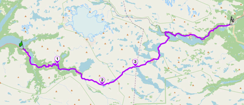
Distance: 90 km (Eidfjord to Geilo)
Altitude: 1,250 m (approx., Dyranut area)
Best for: High-plateau touring, Vøringsfossen, big-sky decompression
Best time: June to September (road open year round, winter convoy closures possible)
The Route:
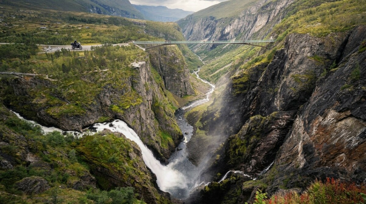
Rv7 crosses Hardangervidda, the largest high mountain plateau in Northern Europe and home to its largest wild reindeer herd. From Eidfjord at the fjord, the road climbs the Måbødalen gorge in a sequence of tunnels and ramps, passing Vøringsfossen, a 182 m waterfall and the most visited natural attraction in Norway, now viewable from a stepped footbridge across the gorge. On top, the plateau does the rest. For 60 km the road runs between lakes and bare rock at around 1,200 m, with weather you can watch arriving from 20 km away. The descent east lands in Geilo, a year-round mountain resort town with full amenities. It is the least technical road on this list and one of the most memorable.
Hardangervidda
Rider logic:
Ride it west to east. The Måbødalen climb and the Vøringsfossen stop are better early in the day and in that order. Rv7 is a main east-west artery, so expect steady traffic including campervans in July; the plateau’s long sightlines make passing safe and legal, but hold discipline near crests. Fuel and cafés in Eidfjord and Geilo, with seasonal mountain lodges at Dyranut and Halne on top. The road stays open in winter with convoy driving in storms, but for motorcycles the season is June to September. Wind is the constant: crosswinds on the plateau are strong enough to move a loaded bike a lane’s width. Reindeer have right of way in every sense.
Scenic tip:
The Vøringsfossen footbridge crosses the gorge on 99 steps directly above the drop, and the whole walkway system takes 30 minutes. Go at 08:00 and the coach parties are still at breakfast in Eidfjord. In late afternoon light the plateau itself is the show: westbound sun turns the lakes to metal, which is an argument for riding this road twice, once in each direction.
Ride this route:
Start (Eidfjord): 60.4670, 7.0682
Vøringsfossen: 60.4549, 7.2503
Dyranut: 60.3677, 7.5021
Halne: 60.4323, 7.6799
End (Geilo): 60.5387, 8.2083
Or get the whole route free here, with Scenic: https://scenicapp.space/route/ctDcjtIU
Hardangervidda — Rv7, Vestland and Buskerud
9. Lofoten: E10, Nordland
Distance: 134 km (Å to Svolvær)
Best for: Coastal touring, midnight sun riding, the far north on tarmac
Best time: June to August
The Route:
The E10 through Lofoten is the most scenic stretch of European trunk road in existence. The archipelago is a wall of granite peaks rising straight from the sea, 100 km beyond the Arctic Circle, and the road threads it end to end on bridges and causeways. Start at Å, the village at the literal end of the road, and ride northeast: through Reine, where the peaks circle a harbour of red fishing cabins; across the Fredvang and Flakstad coastline; past the white-sand beaches at Ramberg and Rambergstranda that would pass for the Caribbean if the water were 20 degrees warmer; through Leknes, the commercial centre; and on to Svolvær, the main town, beneath the climbing spire of Svolværgeita. In June and July the sun does not set, and the road never closes for the night.
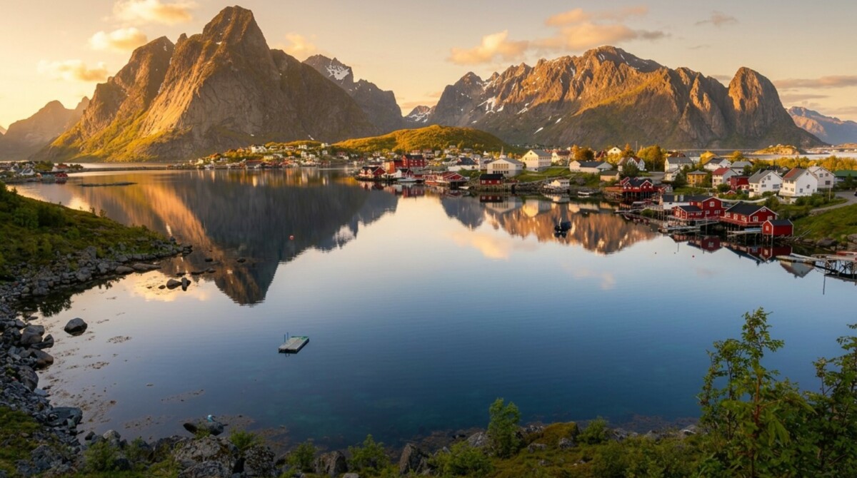
Lofoten
As well as this beautiful stock landscape image of Lofoten (no, really, it does look like that) we actually have a special shot for this one. This is where our CMO Joe first realised that he’d found the right person in his long time riding buddy. Seriously, everyone should go to Lofoten. It’s a magical place.
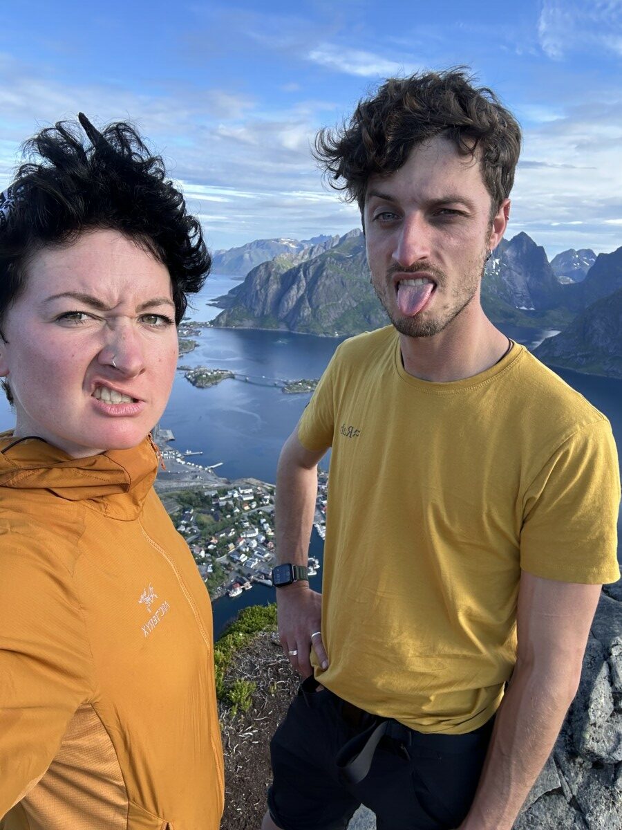
We’re super serious
Rider logic:
Ride it southwest to northeast, Å to Svolvær, keeping the ocean side of the road for the first half. Distances mislead here: 134 km takes a full day because you will stop constantly. Fuel in Å is not guaranteed; fill in Leknes or Svolvær and treat the western tip as a there-and-back from Reine if range is tight. Traffic in July is heavy for a road this size, with campervans and cyclists sharing narrow sections; June and late August are better. The E10 is exposed to sudden weather off the sea, and bridge decks ice into May. Getting there is part of the plan: the car ferry from Bodø to Moskenes lands you 5km from Å, and it fills up in summer, so book the crossing in advance.
Scenic tip:
The midnight sun changes the maths of a riding day. Between late May and mid July, ride the E10’s western section after 22:00: the light goes gold and stays there for hours, the campervans are parked, and you get Reine and Ramberg to yourself. Sleep in, ride at night. It is the only place on this list where that is the correct strategy.
Ride this route:
Start (Å): 67.8806, 12.9821
Reine: 67.9328, 13.0851
Ramberg: 68.0906, 13.2238
Rambergstranda: 68.0978, 13.2375
Leknes: 68.1465, 13.6112
End (Svolvær): 68.2419, 14.5652
Or get the whole route free here, with Scenic: https://scenicapp.space/route/VzhFhwUh
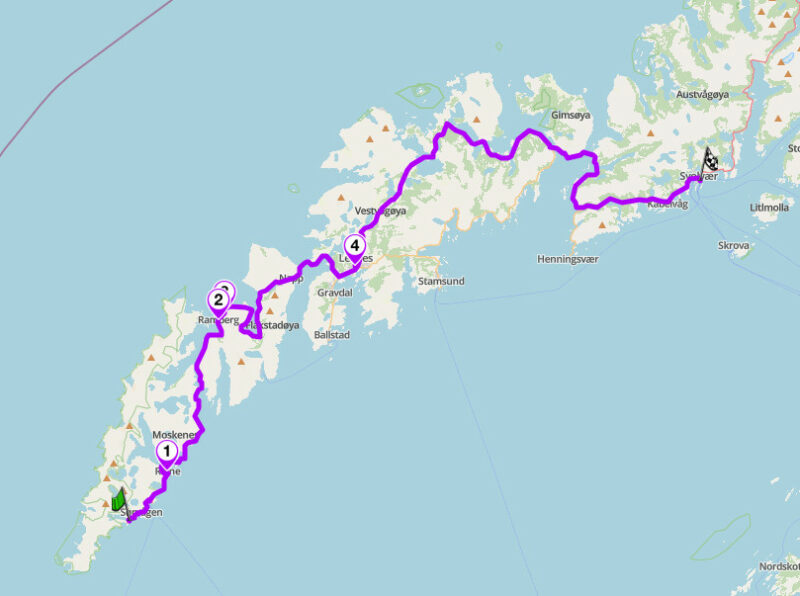
Lofoten — E10, Nordland
10. Senja Coastal Road: Fv862, Troms
Distance: 80 km (Gryllefjord to Botnhamn)
Best for: Lofoten drama without the traffic, tunnels and cliff sweeps, the connoisseur’s north
Best time: June to August
The Route:
Senja is Norway’s second-largest island and the answer for riders who found Lofoten too busy. The Fv862 along the outer coast delivers the same raw material: granite spires straight out of the sea, fishing hamlets, beaches the colour of the tropics. The difference is that you will often have it to yourself. From Gryllefjord, reached by summer ferry from Andenes, the road runs north through a sequence of tunnels and cliff-cut sections firstly over the Bergsbotn viewing platform’s fjord, past Tungeneset, where the Okshornan peaks, the Devil’s Teeth, serrate the horizon, then past the beach at Ersfjord. The route ends at Botnhamn, where the Brensholmen ferry (now running year-round) puts you on the road to Tromsø, about an hour and a quarter’s drive from the quay. As a link between Lofoten, Vesterålen, and Tromsø, it is not a detour. It is the best routing decision in northern Norway.
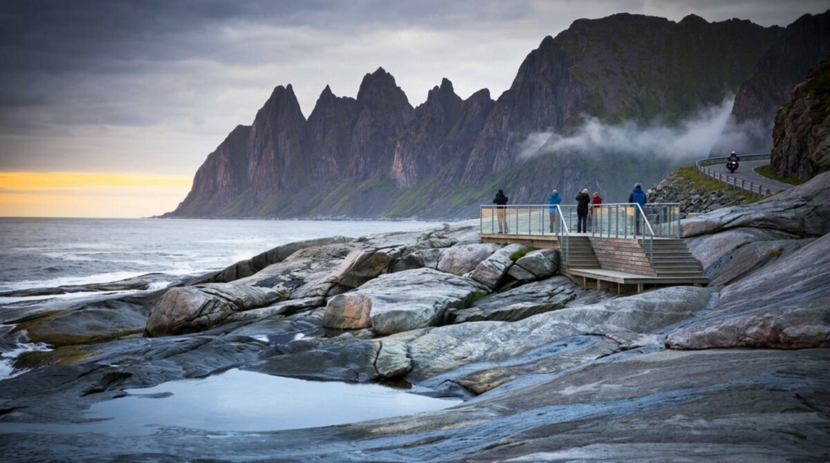
Senja Coastal Road
Rider logic:
Ride it south to north, Gryllefjord to Botnhamn, which chains the two summer ferries into one continuous northbound line from Lofoten to Tromsø. The Andenes to Gryllefjord ferry runs summer only, roughly late May to early September; check timetables and arrive early, because capacity is limited and July sailings fill. The Botnhamn to Brensholmen ferry runs year-round, so it’s less of a planning constraint, but summer sailings still get busy and are first-come, first-served. Fuel is scarce on the outer coast: fill at Finnsnes side or carry range, and do not count on Gryllefjord. Several tunnels are narrow, unlit or dim, and wet; lift the visor and drop the speed before entering. The pull-offs at Tungeneset and Ersfjord have toilets and parking built as part of the National Scenic Route programme. Sea fog can erase the road in minutes and clear as fast.
Scenic tip:
There is no reliable mobile coverage on stretches of Senja’s outer coast, and no shortage of unsigned junctions around the fjord arms. Download the region with Go offline in Scenic before you board the Andenes ferry. Offline maps here are not a convenience feature; they are the difference between riding and guessing when the fog is down and the signal is gone.
Ride this route:
Start (Gryllefjord): 69.3653, 17.0343
Bergsbotn viewing platform: 69.4230, 17.5044
Tungeneset: 69.4867, 17.3325
Ersfjord: 69.4841, 17.4158
End (Botnhamn): 69.5103, 17.9029
Or get the whole route free here, with Scenic: https://scenicapp.space/route/WuhAqYHe
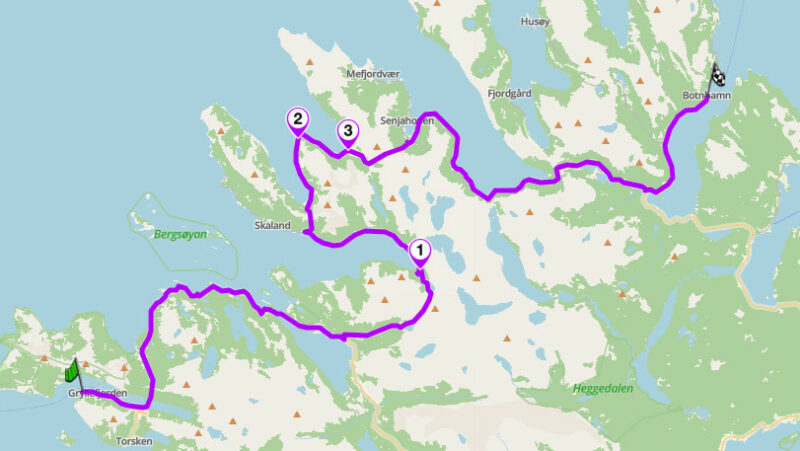
Senja Coastal Road — Fv862, Troms
Planning Your Ride
The Norwegian riding season is short and sharp. The big passes (Sognefjellet, Valdresflye, Aurlandsfjellet, Trollstigen) open between April and mid June depending on snow, and the reliable window for the full list is mid June to mid September. July brings the most traffic and the campervans; June and late August are the sweet spots. North of the Arctic Circle, June and July add the midnight sun, which effectively doubles the usable riding day.
The legal side is simple and strictly enforced. Headlights on at all times (automatic on modern bikes). Helmets mandatory. The blood alcohol limit is 0.02 percent, effectively zero, and enforcement is real. Speed limits are low by European standards, typically 80 km/h on open roads, and fines are among the highest in the world, scaled to income for serious offences. Ride to the limit, not past it.
Tolls and ferries are part of the system. Motorcycles are exempt from almost all Norwegian road tolls, one of the quiet perks of touring here. Ferries do charge for bikes, but they board first and squeeze on when cars are turned away. Most fjord ferries need no booking; the long crossings named in this guide (Bodø to Moskenes, the Senja ferries) should be reserved ahead in July. Register with Epass24 or AutoPASS if your bike is toll-registered at home, and confirm the current exemption rules before travelling.
Distances deceive. Norwegian average speeds are 50 to 60 km/h once fjords, ferries, and photo stops are counted. Plan 250 to 300 km days, not 500. Build your route in Scenic with Plan, adding the ferry quays as via points, and the day’s timing becomes honest instead of optimistic.
Where to base yourself
Åndalsnes: the base for the Golden Route and the Atlantic Ocean Road, with Trollstigen 20 minutes away and the Rauma valley on the doorstep.
Lom: the crossroads of the mountain passes. Sognefjellsvegen, Valdresflye, and Gamle Strynefjellsvegen all start within an hour, and the bakery is a destination in itself.
Aurland or Lærdal: fjord-country hub for the Snow Road and Hardangervidda, with the Flåm valley and Fv50 as bonus rides.
Svolvær: the Lofoten base, with the whole E10 westward and the ferries north to Senja within reach.
Frequently asked questions
When is the best time to ride in Norway? Mid June to mid September for the full country. June and late August have the best traffic-to-weather ratio. For Lofoten and Senja, June and July bring the midnight sun.
When do the mountain passes open? Valdresflye around April, Trollstigen and Sognefjellsvegen typically May, Aurlandsfjellet and Gamle Strynefjellsvegen usually June. Dates move with the snowpack; check vegvesen.no before planning early-season crossings.
Is Trollstigen open? Yes. After rockfall protection work completed in 2025, Trollstigen returned to a normal full season in 2026. Short weather-related closures are still possible during heavy rain, so check the current situation on vegvesen.no before building a trip around it, and have the Geiranger half as the fallback.
Do motorcycles pay tolls in Norway? Motorcycles are exempt from nearly all road tolls. Ferries charge for bikes; fares are modest and bikes board first.
Is lane filtering legal? Filtering is not explicitly regulated in Norwegian law. In practice it is tolerated at low speed in queues. Ride it conservatively; Norwegian traffic culture is orderly and enforcement is unsympathetic to aggression.
Do I need to book ferries? Most short fjord crossings, no: ride up and board. The Bodø to Moskenes crossing to Lofoten and the summer-only Senja ferries, yes, in July especially.
Norway has more coastline than most countries have roads. Pick your fjords, learn the ferry timetables, and go.
Scenic Premium adds turn-by-turn navigation built for riders, a customisable rider-focused display, offline maps for every region in this guide, and automatic curvy routing that keeps you off the tunnels and on the passes. For a country where mobile coverage stops at the fjord wall, it earns its place.
If you go, tag us and use the hashtag #ridewithscenic for your chance to win a free Scenic t-shirt.
You’ve made it to the end of the article! At Scenic we like to reward people who plan their trips properly. If you’re not already a premium member, use this code to get 15% off your first year of Scenic Premium: Premium15


