
 Texas has over 268,000 square miles of riding territory, and most of it is connected by a network of Farm-to-Market and Ranch Roads built for cattle, not tourists. That makes them perfect for motorcycles. The best motorcycle roads in Texas range from tight Hill Country switchbacks to desert canyon roads tracing the Rio Grande. Motorcycle touring in Texas means long days, big distances, and more variety than most states can offer. Motorcycle riding in Texas rewards preparation: fuel stops are sparse, temperatures are extreme, and the wildlife does not care about your line through a corner. This guide covers 10 routes across the state. Each one has been selected for riding character, verified road data, and practical usefulness to riders planning real trips.
In this guide:
Contents
1. The Twisted Sisters: RR 335, RR 336, RR 337, Hill Country
Distance: 95 miles (loop from Leakey);
Key passes: Multiple canyon crossings, no named summit
Best for: Technical riding, experienced riders, weekend loops
Best time: March to May, October to November
The Route:
The Twisted Sisters are the benchmark motorcycle road in Texas. Three Ranch Roads, 335, 336, and 337, form a loop through the Frio and Nueces River canyons northwest of San Antonio. The nickname dates to around 2006, though locals had been calling it the “100-mile loop” for years before that. One 15-mile section of RR 335 contains approximately 65 curves. The roads follow canyon floors before climbing jagged limestone hills with steep grades and minimal guardrails. Each sister has a distinct character: RR 337 is the warm-up with better sight lines, RR 335 is a roller coaster of dips and elevation changes, and RR 336 delivers tight twists with free-range cattle as a bonus hazard.
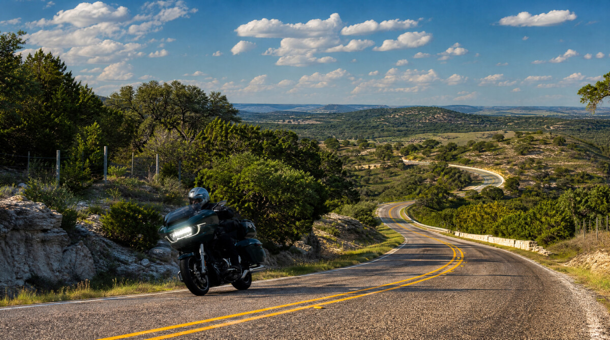
The Twisted Sisters
Ride the loop counter-clockwise starting from Leakey. You hit RR 337 first to build confidence with the road surface, then tackle RR 335 when you are fully dialled in, and finish on RR 336 when fatigue starts to set in. This order also puts the sun at your back for most of the afternoon if you start mid-morning. Fuel up in Leakey before you leave. Camp Wood has a small station at the junction of RR 337 and RR 335, but hours are unreliable. Vanderpool is similarly limited. If your bike gets under 150 miles per tank, plan your stops carefully. The Frio Canyon Motorcycle Stop in Leakey is the unofficial base camp for Twisted Sisters riders: decent food, cold drinks, and other riders to compare notes with. The Lone Star Motorcycle Museum is worth a short detour north of Vanderpool on RM 187. Deer, wild hogs, and cattle all share these roads. Rock falls are common. TxDOT data indicates 18% of crashes on this route involve striking a rock embankment.
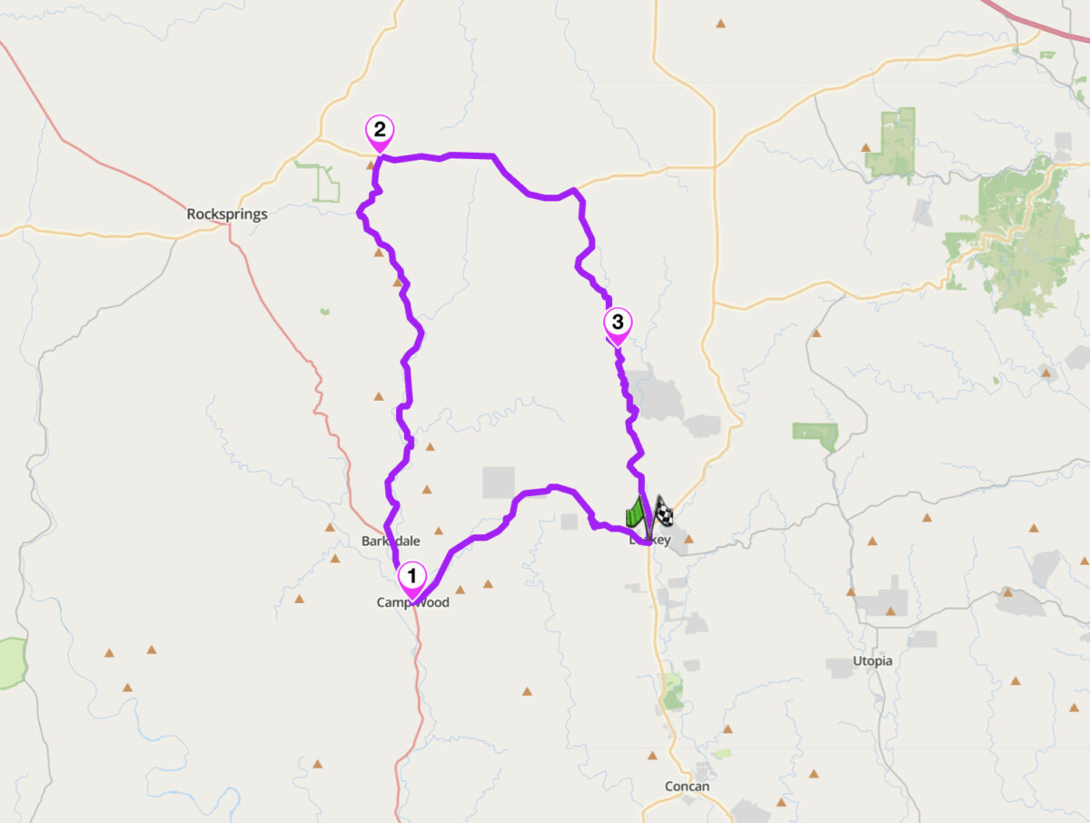
The Twisted Sisters — RR 335, RR 336, RR 337, Hill Country
Scenic tip:
Stop at the Frio Canyon Motorcycle Stop in Leakey before or after your loop. It is the social hub for riders on the Sisters, and the staff can tell you about current road conditions, recent rock falls, and which sections have fresh gravel. The Bent Rim Grill next door does a solid bacon cheeseburger with sweet potato fries.
Ride this route:
Start/End (Leakey): 29.7268, -99.7620
Waypoint (Camp Wood, RR 337/RR 335 junction): 29.6725, -100.0155
Waypoint (RR 335/TX 41 junction): 30.077591, -100.046546
Or get the whole route free here, with Scenic: https://scenicapp.space/route/yBrITLVV
2. River Road: FM 170, Presidio to Study Butte, West Texas
Distance: 69 miles (Presidio to Study Butte via Lajitas and Terlingua)
Altitude: Big Hill summit approximately 4,600 ft
Key passes: Big Hill (highest sustained grade on this route)
Best for: Desert scenery, solitude, adventure touring
Best time: October to April
The Route:
FM 170 deserves to be mentioned alongside the Pacific Coast Highway and the Blue Ridge Parkway, but it is not, because it is 200 miles from the nearest city of any size. Known locally as the River Road or El Camino del Rio, it traces the Rio Grande through Big Bend Ranch State Park. The 50-mile core section from Presidio to Lajitas hugs the river through arroyos and canyon walls, climbing and descending as the terrain dictates. Between Redford and Lajitas, the road climbs what locals call Big Hill: the steepest sustained highway grade in Texas, marked by warning signs in both directions. From the summit, the view stretches east to the Chisos Mountains 75 miles away and west into Colorado Canyon and deep into Mexico. The road continues east from Lajitas through Terlingua, a former mining ghost town turned artist community, to Study Butte near the entrance to Big Bend National Park.
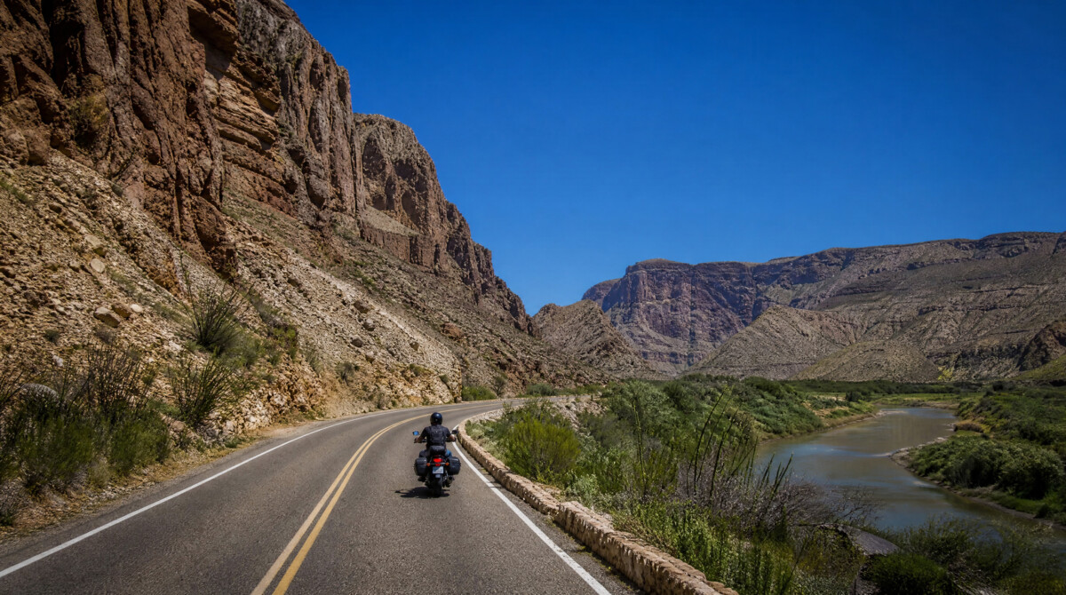
Ride east to west for the dramatic descent down Big Hill. Ride west to east to build into the scenery gradually. Either direction works. The critical logistics point is fuel: fill up in Presidio (if starting there). The Lajitas General Store carries regular fuel only. There is no reliable fuel between Presidio and Lajitas, a stretch of 50 miles. Cell coverage is effectively zero for most of the route. AT&T performs best in this region, but expect long dead zones. Temperatures can exceed 100°F by midday from May onwards. Carry at least one gallon of water per rider. The road surface is paved and generally well-maintained, but recent rains can wash debris onto the road and erode shoulders. Entry to Big Bend Ranch State Park is $5 per person over 13, or free with a Texas State Parks Pass. Driving through on FM 170 itself is free.
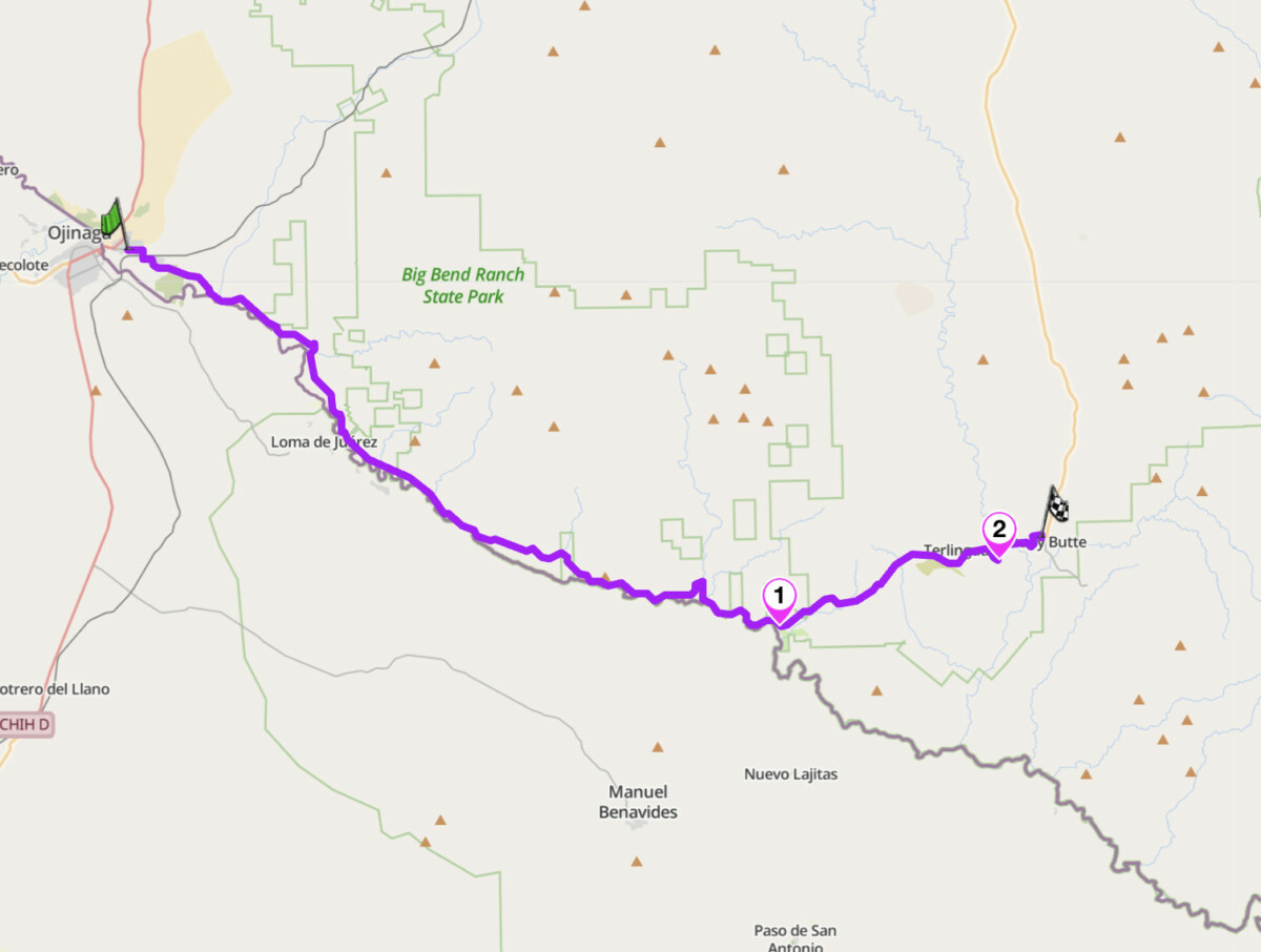
River Road — FM 170, Presidio to Study Butte, West Texas
Scenic tip:
At the top of the climb between Redford and Lajitas, known locally as Big Hill, there is a pullover on the south side of the road. Look for Dom Rock: a boulder with “DOM” carved into its face, made famous by the 1985 Kevin Costner film Fandango. It is a more reliable landmark than the road signs. The view from here stretches east to the Chisos Mountains and west into Colorado Canyon. On a clear morning you can see deep into Mexico. Most riders pass it at speed. Coordinates: 29.2960, -103.9418. Stop. This is why you came.
Ride this route:
Start (Presidio): 29.5607, -104.3692
Waypoint (Big Hill viewpoint): 29.2960, -103.9418
Waypoint (Lajitas): 29.2706, -103.7630
Waypoint (Terlingua): 29.3205, -103.6108
End (Study Butte): 29.3270, -103.5560
Or get the whole route free here, with Scenic: https://scenicapp.space/route/lyGxGQuY
3. Devil’s Backbone: RM 32, Comal/Hays Counties, Hill Country
Distance: 54 miles (Wimberley loop via RM 12, RM 32, US 281, return via FM 165/FM 2325)
Altitude: 1,274 ft at the ridge summit
Best for: Scenic touring, accessible from Austin or San Antonio, half-day ride
Best time: Year-round; spring for wildflowers
The Route:
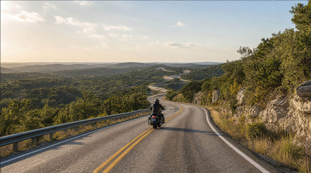
The Devil’s Backbone is a limestone ridge running east to west along the Hays/Comal county line, 13 miles north of New Braunfels. The riding section on RM 32 is short, roughly 20 miles, but it sits on a razor-backed ridge with long views over the Balcones Escarpment. The overlook at the roadside park on RM 32 is one of the most photographed spots in the Hill Country. The road itself is a series of sweeping curves with decent sight lines, threading through live oak and Ashe juniper. It is accessible, well-surfaced, and a natural pairing with nearby rides.
The most popular loop starts in Wimberley, takes RM 12 south to RM 32, follows the backbone west to US 281, then loops back through Blanco and returns via FM 165/FM 2325. The full Wimberley-Devil’s Backbone-Blanco-Luckenbach-Fredericksburg loop covers 122 miles and takes 2 to 4 hours. This extension turns a short ridge ride into a proper day out, passing through Luckenbach and ending in Fredericksburg, where German heritage meets Hill Country hospitality. Fischer Store Road, connecting RM 32 to Blanco, is worth riding for its own curves. Deer are a serious hazard on these roads, especially at dawn and dusk. Fuel and food are available in Wimberley and Blanco.
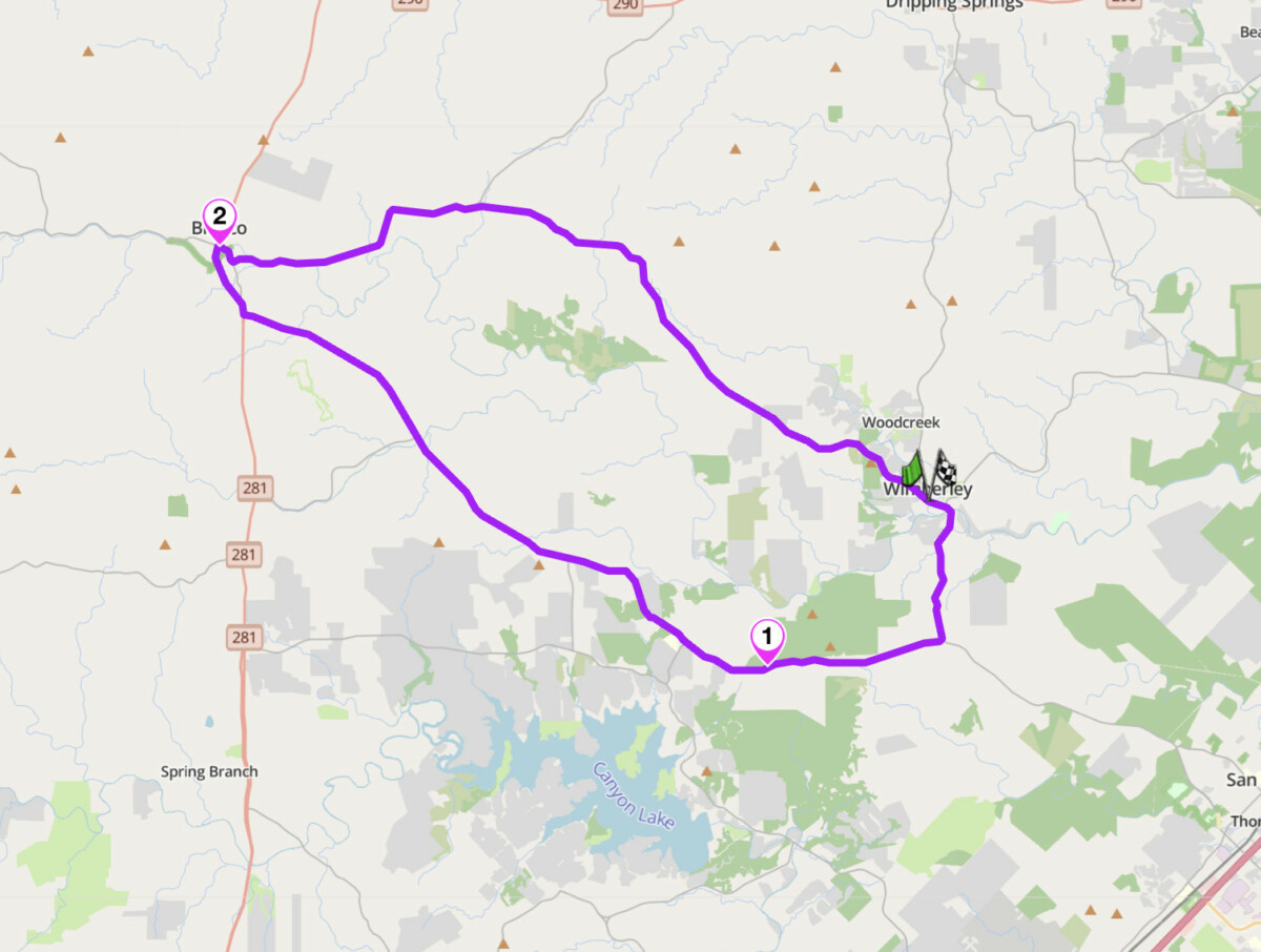
Devil’s Backbone, RM 32, Comal/Hays Counties
Scenic tip:
The Devil’s Backbone Overlook on RM 32 has a grassy picnic area with a chain-link fence covered in memorial crosses. The view stretches to a hazy blue line on the horizon. Most riders blow past the turnoff. The sign comes up fast heading west on RM 32, a few miles after the RM 12 split. Slow down and look for it on the right.
Ride this route:
Start/End (Wimberley): 29.9974, -98.0986
Waypoint (Devil’s Backbone Overlook, RM 32): 29.9333, -98.1667
Waypoint (Blanco): 30.0972, -98.4219
Or get the whole route free here, with Scenic: https://scenicapp.space/route/iXvprrBx
4. Palo Duro Canyon Loop — TX 207, Texas Panhandle
Distance: 163 miles (loop from Amarillo via Claude, Clarendon, Silverton)
Altitude: Canyon rim approximately 3,500 ft; floor drops 800 ft
Best for: Canyon scenery, open-road cruising, big sky scenery
Best time: March to May, September to November
The Route:
Palo Duro Canyon is the second-largest canyon in the United States, and most motorcyclists have never heard of it. The big loop from Amarillo heads east on US 287 through Claude to Clarendon, picks up TX 70 south to Silverton, then takes TX 207 north back across the canyon to Claude. The two canyon crossings are the highlights: the road drops through layered red and orange rock formations, with tight curves and elevation shifts that contrast sharply with the arrow-straight plains surrounding them. The rest of the loop is classic Panhandle plains: big sky, open road, distant horizons. Inside Palo Duro Canyon State Park, a separate 16-mile park road drops 800 feet to the canyon floor. Entry is $8 per person.
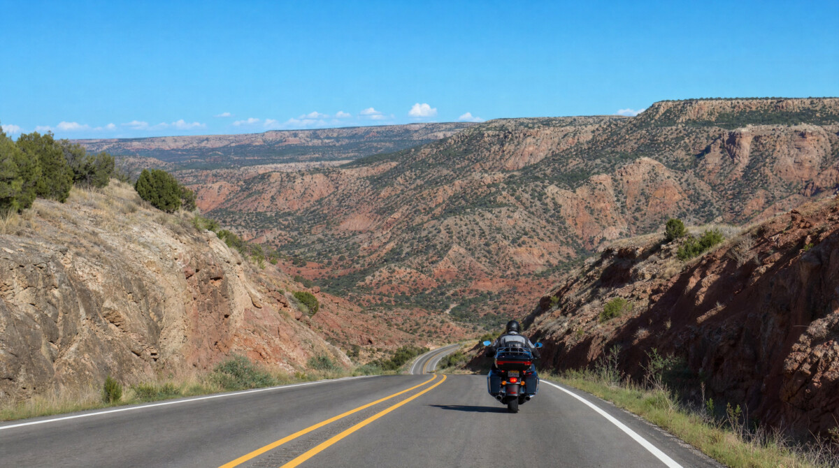
Fill up before leaving Amarillo and again in Clarendon. There is not much fuel between Amarillo and Clarendon, and even less between Clarendon and Silverton. Weather in the Panhandle changes fast: clear sky can become a thunderstorm with hail in 20 minutes. Check forecasts before you ride and have a plan for shelter. The TX 207 rest stop near the canyon rim has a panoramic viewpoint worth stopping for. Wind is a constant factor on the open plains sections. If you have time, spend a night and catch the canyon at sunrise, when the red rock glows.
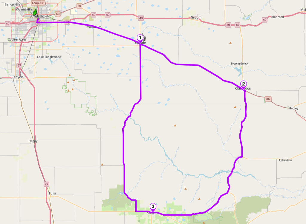
Palo Duro Canyon Loop
Scenic tip:
Download Scenic’s offline maps for this route before leaving Amarillo. Cell coverage is unreliable between Claude and Silverton, and the canyon crossings can disorient your sense of direction on roads you do not know.
Ride this route:
Start/End (Amarillo): 35.1814, -101.7940
Waypoint (Claude): 35.1117, -101.3633
Waypoint (Clarendon): 34.9383, -100.8880
Waypoint (Silverton): 34.4731, -101.3042
Or get the whole route free here, with Scenic: https://scenicapp.space/route/wVNKqMEN
5. Willow City Loop — FM 1323, Gillespie County
Distance: 13 miles (loop only); 60 miles combined with Enchanted Rock and Fredericksburg
Best for: Wildflower riding, photography, short highlight ride, not to be missed in spring
Best time: Late March to early May (peak wildflowers); any season for scenery
The Route:
The Willow City Loop is a 13-mile stretch of narrow ranch road northeast of Fredericksburg that winds through some of the oldest geology in central Texas. In spring, the valley floors and hillsides are covered in bluebonnets, Indian paintbrush, phlox, and coreopsis so dense they look like standing water from a distance. The road passes through canyons carved by Coal Creek, with panoramic views from ridge tops and low water crossings at the bottom. It is the number one wildflower viewing road in Texas. On spring weekends it is also the most congested. This is a 45-minute ride at most. Plan the rest of the day around it.
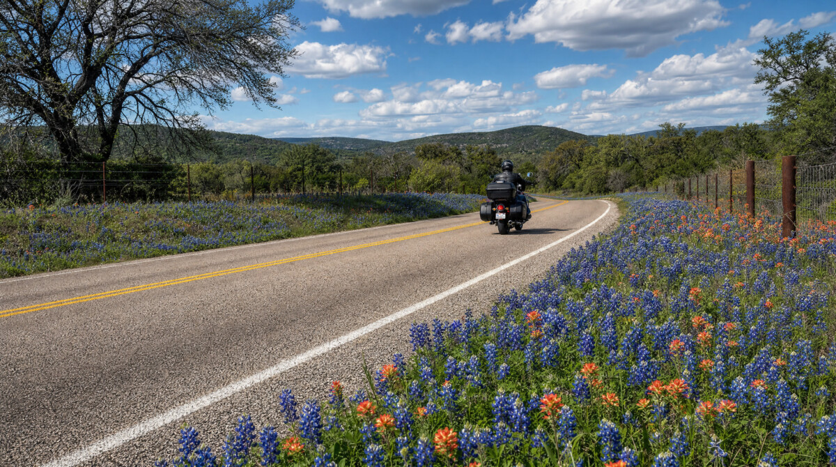
Combine it with FM 965 north from Fredericksburg past Enchanted Rock to TX 16, then TX 16 south four miles to the Loop road entrance. That gives you a 60-mile day with two of the best roads in the Hill Country back to back. On peak wildflower weekends, the loop has genuine traffic jams through Willow City itself. Ride midweek or before 9 AM on weekends. The road is narrow, there are cattle guards and low water crossings, and wildflower photographers in cars will stop without warning. Harry’s on the Loop in Willow City does cold beer and basic food. All land along the loop is privately owned: do not stop on private property, block driveways, or walk into fields.
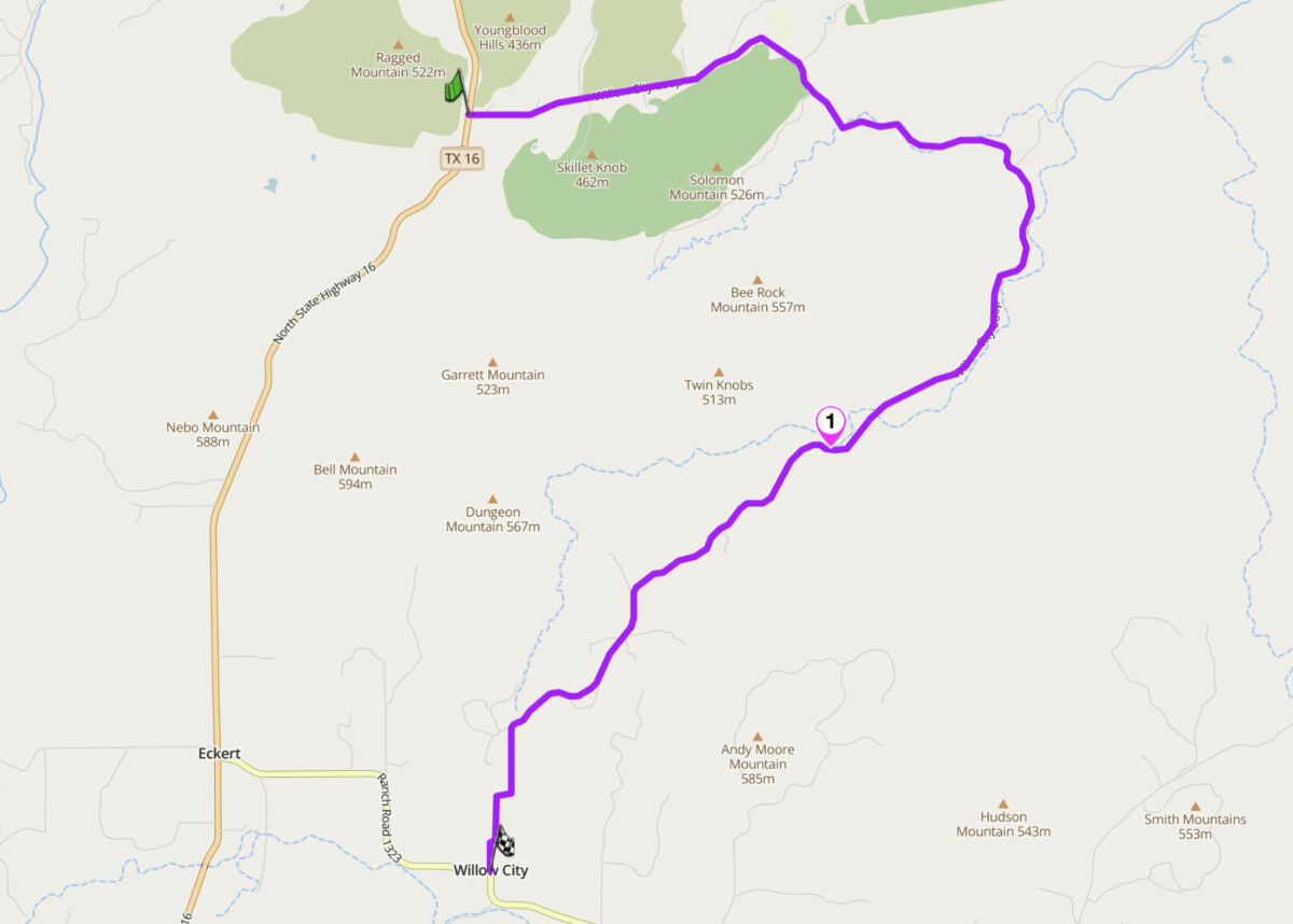
Willow City Loop
Scenic tip:
The best wildflower concentration is in the second half of the loop, riding south to north. At Cottonwood Hollow, the streambed fills with bluebonnets. Coordinates: 30.44992, -98.66003. If the flowers are good at Wildseed Farms on US 290 near Fredericksburg, they will be better out here.
Ride this route:
Start (Willow City, FM 1323/Willow City Loop junction): 30.40138, -98.70138
Waypoint (Cottonwood Hollow): 30.44992, -98.66003
End (TX 16 junction): 30.447600, -98.657500
Or get the whole route free here, with Scenic: https://scenicapp.space/route/EOGutFki
6. FM 1431 — Cedar Park to Marble Falls, Hill Country
Distance: 43 miles (Cedar Park to Marble Falls); 29 miles for the best section (Lago Vista to Marble Falls)
Best for: After-work rides from Austin, flowing curves, lake views
Best time: Year-round; best in spring and fall
The Route:
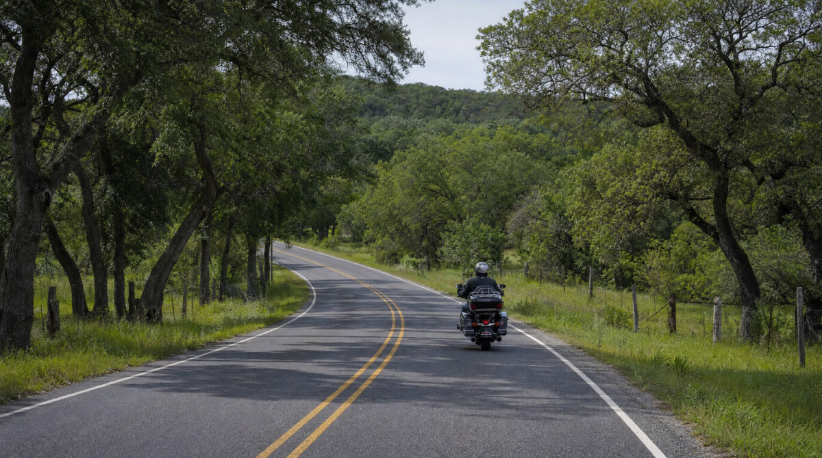
FM 1431 is the road that Austin-area riders default to when they have a free afternoon. It starts as a divided highway heading west out of Cedar Park, but after Lago Vista it narrows to two lanes and the Hill Country begins. The road follows the north shore of Lake Travis with elevation changes, sweeping curves, and views over the water and limestone bluffs. It passes through the Balcones Canyonlands National Wildlife Refuge. The surface is excellent. Traffic is the main variable: on weekdays it is manageable, on weekends it can back up behind slower vehicles.
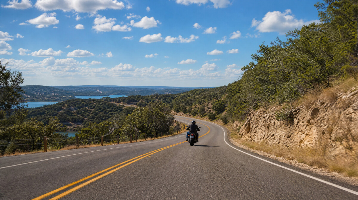
Combine FM 1431 with Lime Creek Road for a loop that delivers over 200 turns in under 75 miles. Lime Creek Road, just east of FM 1431, has tight hairpins and technical bends popular with sport bike riders, but limestone gravel on the road surface is a recurring hazard. The Blue Bonnet Cafe in Marble Falls has been serving homestyle meals since 1929 and is a natural end point. Park Road 4 through Inks Lake State Park, just north of Marble Falls, adds another 8 miles of spirited riding on a good surface. Two cattle grates on FM 1431 west of Lago Vista can catch riders by surprise. Police presence is common on the four-lane section near Cedar Park.
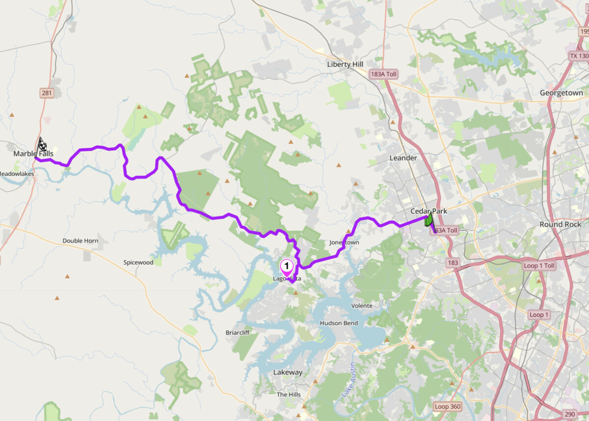
FM 1431
Scenic tip:
Use Scenic’s curvy routing mode when planning a loop from Austin to Marble Falls. The default routing will send you on US 183 or TX 71. Curvy mode routes you through FM 1431 and the back roads around the Balcones Canyonlands, which is exactly what you want.
Ride this route:
Start (Cedar Park, FM 1431/US 183): 30.5160, -97.8200
Waypoint (Lago Vista): 30.4430, -97.9880
End (Marble Falls): 30.5783, -98.2750
Or get the whole route free here, with Scenic: https://scenicapp.space/route/fqJxxZir
7. TX 16 — Kerrville to Fredericksburg, Hill Country
Distance: 25 miles
Best for: Touring pace, winery stops, connecting Hill Country rides
Best time: Year-round; spring for wildflowers, fall for cooler temperatures
The Route:
TX 16 between Kerrville and Fredericksburg is the main artery of the Hill Country motorcycle network. It is not the most technical road on this list, but it is the one that connects everything else. The road rolls through classic Hill Country terrain: oak-dotted hills, open ranch land, and small creek crossings. Kerrville sits on the Guadalupe River and serves as a southern gateway to the Twisted Sisters. Fredericksburg, with its German heritage architecture, craft breweries, and the National Museum of the Pacific War, is the natural base for a multi-day Hill Country trip. Between the two towns, the road passes through rolling terrain with long sight lines and a consistent surface.
TX 16 is the road that connects you to the Willow City Loop (turn right onto FM 1323, 13 miles north of Fredericksburg) and to Enchanted Rock State Natural Area via FM 965. South from Kerrville, TX 16 continues to Bandera, the self-proclaimed Cowboy Capital of the World, which has multiple biker-friendly bars and restaurants. The road carries more traffic than the ranch roads, but it is well-surfaced and overtaking opportunities are frequent. Fuel is available in both Kerrville and Fredericksburg, and in Medina if you are heading toward the Twisted Sisters.
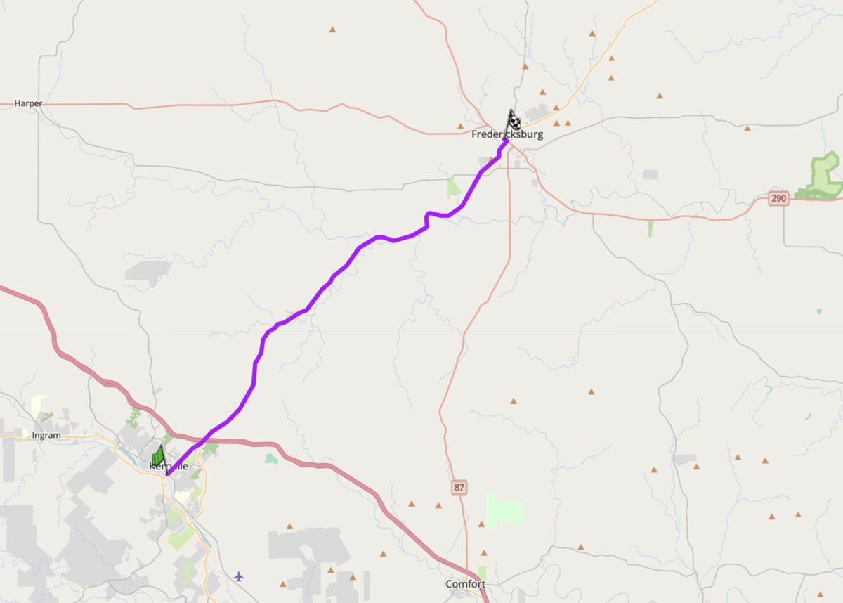
TX 16
Scenic tip:
If you are riding south from Fredericksburg toward Kerrville and plan to continue to the Twisted Sisters, stop in Medina at Keese’s Bar-B-Que for breakfast before picking up RR 337 westbound. It sets you up for the whole day.
Ride this route:
Start (Kerrville): 30.0474, -99.1403
End (Fredericksburg): 30.2752, -98.8720
Or get the whole route free here, with Scenic: https://scenicapp.space/route/yTxewlXz
8. Ross Maxwell Scenic Drive — Big Bend National Park, West Texas
Distance: 30 miles one way (Santa Elena Junction to Santa Elena Canyon overlook)
Altitude: 1,800 to 3,500 ft
Best for: Desert scenery, geological formations, short highlight ride, not to be missed
Best time: October to March
The Route:
Ross Maxwell Scenic Drive is a 30-mile paved road inside Big Bend National Park that descends from the Chisos Mountains basin toward Santa Elena Canyon on the Rio Grande. It passes through terrain that looks like another planet: volcanic rock formations, desert scrub, and views that stretch into Mexico. The road is well-maintained and the gradients are manageable, but the landscape demands a slower pace. At the end, the Santa Elena Canyon overlook presents 1,500-foot limestone walls rising from the river. The route is short by Texas standards. You go back the same way or continue on the main park road. Either way, it is worth the journey to reach it.
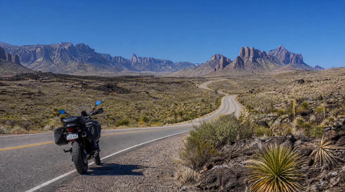
The 30-mile drive takes well under an hour one way. To build a full day around it, combine it with the Chisos Basin Road (a steep climb into the heart of the mountains) and the drive from Panther Junction to the park’s west entrance. The total park loop from Panther Junction to Santa Elena and back via the main road covers roughly 80 miles. Big Bend National Park entry is $20 per motorcycle, valid for seven days. Fuel is not available inside the park. Fill up in Study Butte or Marathon before entering. Temperatures inside the park can exceed 104°F in summer. Carry water. The nearest motorcycle services are in Alpine, 100 miles north.
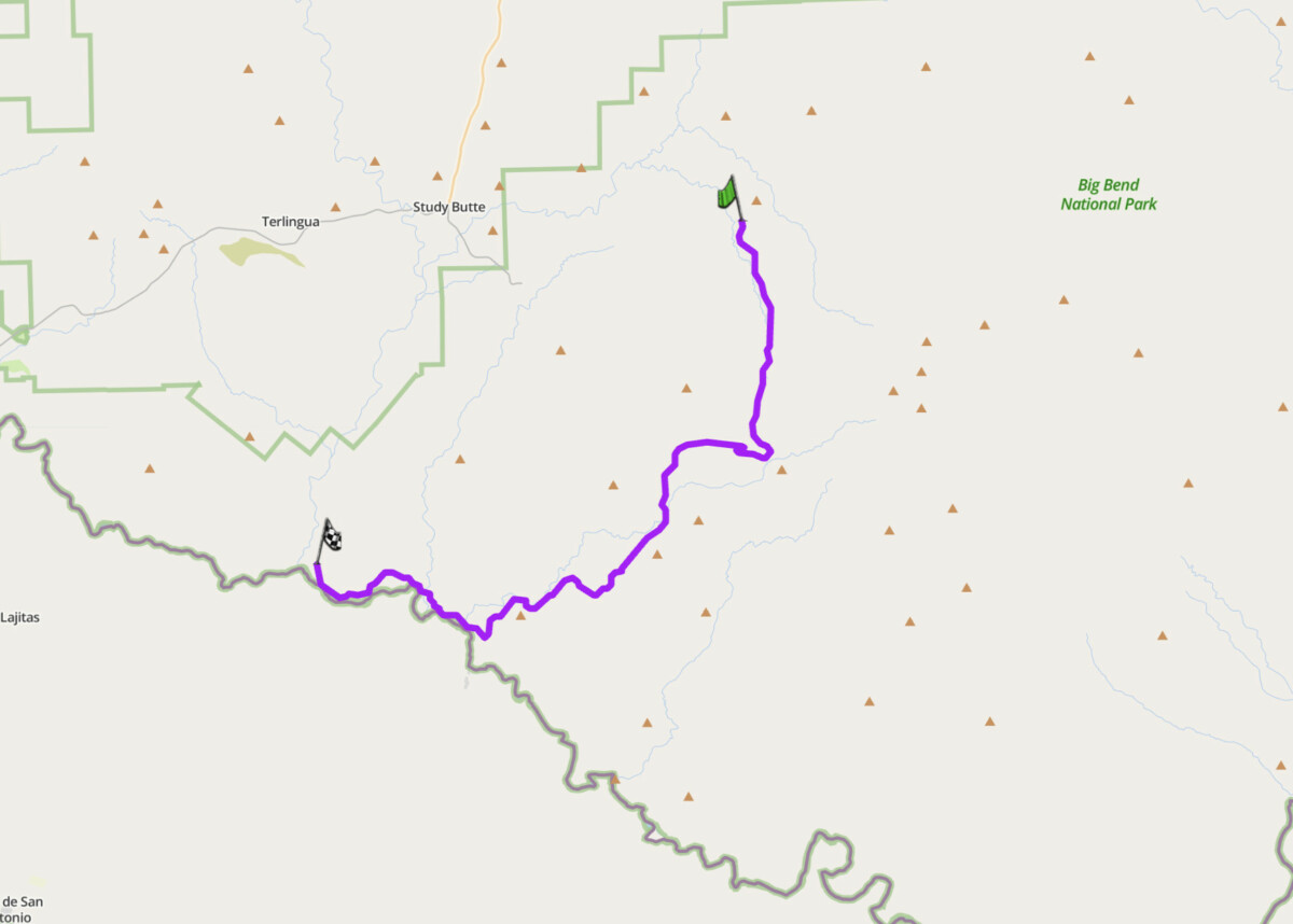
Ross Maxwell Scenic Drive
Scenic tip:
Use Scenic’s Round Trip feature from Study Butte or Terlingua to build a full-day loop incorporating Ross Maxwell, Chisos Basin Road, and the eastern park road to Rio Grande Village. This turns a short scenic drive into a 4-hour ride through three distinct landscapes.
Ride this route:
Start (Santa Elena Junction): 29.2350, -103.3600
End (Santa Elena Canyon overlook): 29.1680, -103.6000
Or get the whole route free here, with Scenic: https://scenicapp.space/route/wRdFekWz
9. Bluewater Highway and Bolivar Peninsula — FM 3005/TX 87, Gulf Coast
Distance: 73 miles (Surfside Beach to High Island via Galveston, ferry, and Bolivar Peninsula)
Best for: Coastal cruising, decompression riding, seafood
Best time: October to May (avoid summer humidity and hurricane season)
The Route:
Texas has over 350 miles of Gulf coastline, and this route captures the best of it. The ride links Surfside Beach, Galveston Island, and the Bolivar Peninsula into a single coastal loop that includes a free ferry crossing of Galveston Bay. FM 3005 (Bluewater Highway) runs 40 miles from Surfside Beach northeast along the Gulf to Galveston, with the ocean on your right the entire way. In Galveston, Seawall Boulevard adds another 10 miles of beachfront riding. From the east end of the island, the Galveston-Bolivar Ferry takes you and your bike on an 18-minute crossing of the Houston Ship Channel: free, dolphins alongside, container ships overhead. On the Bolivar Peninsula, TX 87 runs 30 miles northeast to High Island through one of the most remote stretches of undeveloped coast in the state.
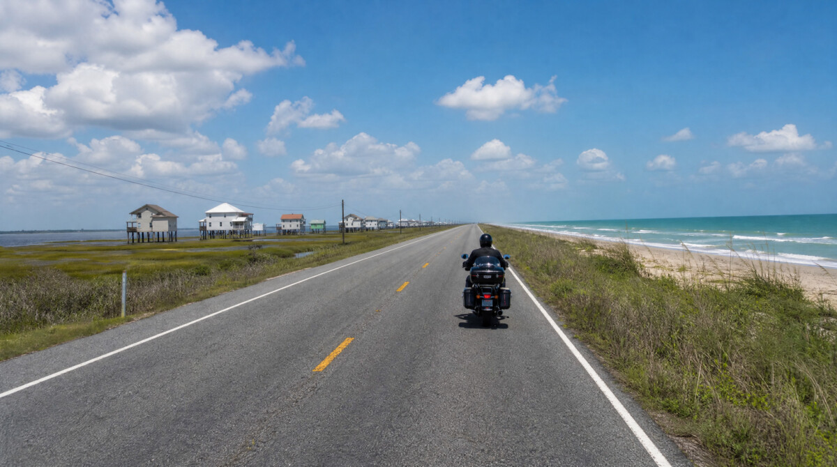
The ferry from Galveston to Bolivar runs 24 hours a day. During peak season and weekends, wait times can exceed 30 minutes. Motorcycles load last and unload first. Fuel up in Galveston before boarding. The Bolivar Peninsula has limited services. Crystal Beach has a few restaurants and a fuel stop, but hours can be irregular. High Island, at the northeast end, is one of the top migratory bird viewing sites in the United States during spring. The return to Houston from High Island via TX 124 and I-10 takes about 90 minutes. Wind is a constant on the peninsula and Seawall Boulevard. Sand on the road surface is common along TX 87.
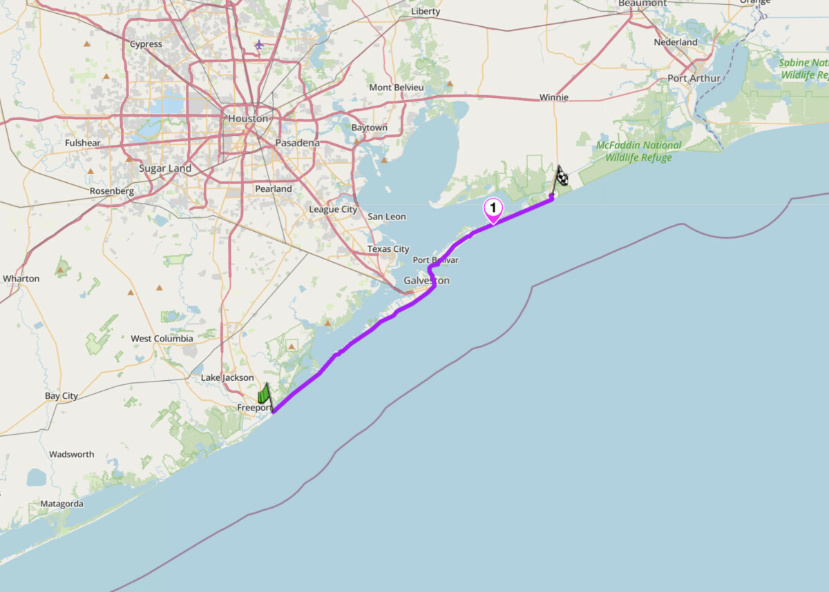
Bluewater Highway and Bolivar Peninsula
Scenic tip:
On the ferry crossing, head to the upper observation deck. You will see shrimp boats, container ships, the Bolivar Lighthouse, and frequently dolphins following the wake. It is 18 minutes of free entertainment and one of the most memorable moments on any Texas motorcycle trip.
Ride this route:
Start (Surfside Beach, FM 3005): 29.0430, -95.2880
Waypoint (Galveston ferry terminal): 29.2853, -94.7878
End (High Island, TX 87/TX 124): 29.5560, -94.3870
Or get the whole route free here, with Scenic: https://scenicapp.space/route/cSXbVUdZ
10. TX 377 and TX 144 — Cresson to Glen Rose, North Texas
Distance: 30 miles
Best for: North Texas riders, accessible day ride from DFW, historic small towns
Best time: Year-round; best in spring and fall
The Route:
FM 4 is the ride that Dallas-Fort Worth riders reach for when the Hill Country is too far. Running from Cresson through Granbury to Glen Rose, it offers a mix of long straights, gentle curves, and enough scenery to make it worth a tank of fuel. The road passes through the Brazos River valley with open ranch views, a well-preserved historic courthouse square in Granbury, and tree-canopied sections heading south. Glen Rose, at the end, is home to Dinosaur Valley State Park, where actual dinosaur tracks are preserved in the riverbed. It is not Hill Country-level riding, but for a half-day escape from the Metroplex, it delivers.
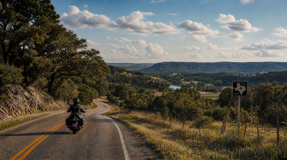 From Glen Rose, extend the ride south on US 67 to pick up winding roads around Palo Pinto and Possum Kingdom Lake via FM 129, adding another 60 miles of hilly terrain with better curves. This turns a short ride into a proper full day. Fuel is available in Cresson, Granbury, and Glen Rose. Traffic on FM 4 is generally light, but watch for agricultural vehicles on weekday mornings. The Granbury courthouse square is a good mid-ride stop.
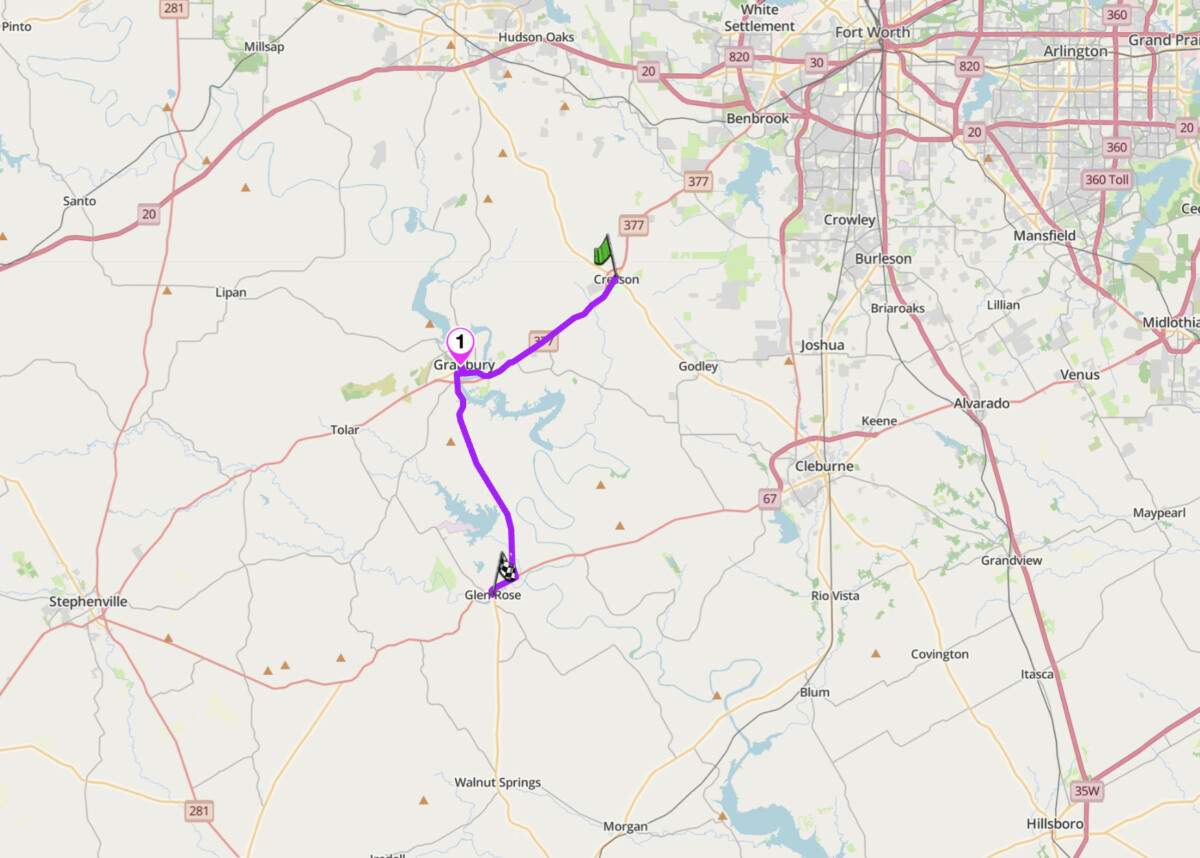
TX 377 and TX 144
Scenic tip:
Download Scenic’s offline maps before extending from Glen Rose toward Possum Kingdom Lake. The FM roads around Palo Pinto have patchy cell coverage, and the turns through the Palo Pinto Mountains are easy to miss without navigation.
Ride this route:
Start (Cresson, FM 4/US 377 junction): 32.3970, -97.6140
Waypoint (Granbury): 32.4419, -97.7942
End (Glen Rose): 32.2343, -97.7553
Or get the whole route free here, with Scenic: https://scenicapp.space/route/kTeVttZw
Planning Your Ride
When to go
Texas riding season is year-round, but comfort varies dramatically by region and month. The Hill Country and West Texas are best from October through May. Summer temperatures in the Big Bend region regularly exceed 100°F and can hit 110°F. The Gulf Coast is humid year-round but rideable in winter. The Panhandle gets cold from December through February, with ice on the roads. Spring (March to May) is the sweet spot statewide: wildflowers in the Hill Country, manageable temperatures in the desert, and long daylight hours. Fall (October to November) is the second-best window.
Texas motorcycle law
Texas motorcycle law requires headlights on at all times. Eye protection is mandatory unless your bike has a windscreen. The helmet law is partial: riders under 21 must wear a helmet, riders 21 and over may ride without one if they have completed a DPS-approved safety course and carry minimum health insurance. Lane splitting is illegal. Handlebars cannot exceed the shoulder height of the seated rider. Liability insurance is mandatory (minimum $30,000 per person). There is no state motorcycle inspection requirement as of 2025.
Fuel planning
Fuel planning is critical outside urban areas. West Texas and Panhandle routes can have 80-mile gaps between stations. Hill Country routes are better served, but smaller towns keep irregular hours. Always start a ride with a full tank. For any route west of I-35, download Scenic’s offline maps before you leave. Cell coverage becomes unreliable at range, and getting caught without navigation on a West Texas road with no fuel and no signal is avoidable with ten minutes of prep.
Where to base yourself
Fredericksburg is the hub for the Hill Country. The Twisted Sisters, Devil’s Backbone, Willow City Loop, and FM 1431 are all within a 90-minute ride. It has the best food, accommodation, and fuel infrastructure of any Hill Country town, plus the National Museum of the Pacific War for a rest day.
Alpine is the base for West Texas. River Road, Ross Maxwell Scenic Drive, and Big Bend are all accessible from here. It has the only reliable motorcycle services in the region.
Amarillo serves the Panhandle, with Palo Duro Canyon 25 miles south and Route 66 running through the city.
Kerrville is the southern gateway to the Twisted Sisters and sits on the Guadalupe River. Quieter than Fredericksburg, with direct access to TX 16 and RR 337 westbound.
Frequently asked questions
What is the best time of year to ride a motorcycle in Texas? Spring (March to May) is the best season statewide. Temperatures are manageable, wildflowers are in bloom in the Hill Country, and the desert is not yet dangerously hot. Fall (October to November) is the second-best window. Avoid West Texas and the Panhandle in summer unless heat above 100°F is your preference.
Are the Twisted Sisters dangerous? They demand respect. TxDOT crash data shows the majority of incidents on RR 335, 336, and 337 are single-vehicle crashes caused by excessive speed on curves. Rock falls, loose gravel, free-range cattle, and blind crests are recurring hazards. Experienced riders who stay within their limits and ride the route counter-clockwise report it as one of the best rides in the country. New riders should build skills elsewhere first.
Do you need a helmet to ride a motorcycle in Texas? Riders under 21 must wear a helmet. Riders 21 and over may ride without one if they have completed a DPS-approved safety course and carry at least $10,000 in health insurance covering motorcycle injuries. Eye protection is mandatory for all riders unless the motorcycle has a windscreen.
What are the fuel gaps on Texas motorcycle routes? West Texas has the longest gaps. Between Presidio and Lajitas on FM 170 there is no reliable fuel for 50 miles. The Panhandle loop around Palo Duro Canyon can have 60 to 80 mile stretches between stations. Hill Country routes are better served, but small-town stations keep irregular hours. Always start with a full tank.
Can you ride motorcycles in Big Bend National Park? Yes. Entry is $20 per motorcycle, valid for seven days. Ross Maxwell Scenic Drive, Chisos Basin Road, and the road to Rio Grande Village are all paved and open to motorcycles. There is no fuel inside the park. Fill up in Study Butte or Marathon before entering.
Is lane splitting legal in Texas? No. Lane splitting is illegal in Texas. Filtering at traffic lights is also prohibited. Ride within your lane at all times.
Texas has more good riding roads than any single trip can cover. Pick your region, plan your loop, and ride.
Scenic Premium gives you turn-by-turn navigation designed for motorcyclists, global offline maps, and automatic curvy routing that avoids highways and keeps you on the roads worth riding. If you are planning a multi-day Texas trip, it is the difference between a good ride and a great one.
If you go, tag us and use the hashtag #ridewithscenic for your chance to win a free Scenic t-shirt.
You’ve made it to the end of the article! At Scenic we like to reward people who plan their trips properly. If you’re not already a premium member, use this code to get 20% off your first year of Scenic Premium: SCENICBLOG20


